Publications Directory
Sand and Gravel Mining in Prince George's County Past, Present, and Future
Title:
Sand and Gravel Mining in Prince George's County Past, Present, and Future
Author:
The Maryland-National Capital Park and Planning Commission
Prince George's County Planning Department
Publication Date:
07/01/2020
Source of Copies:
The Maryland-National Capital Park and Planning Commission
14741 Governor Oden Bowie Drive
Upper Marlboro, MD 20772
Number of Pages:
108
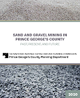
The Community Planning Division of The Maryland-National Capital Park and Planning Commission, Prince George’s County Planning Department, conducted this study in response to an inquiry by the Prince George’s County Council on the status of the sand and gravel extraction industry and opportunities for adaptive reuse of closed sand and gravel mines. This report reflects information collected in literature searches, a geographic information system (GIS) survey of sand and gravel extraction sites, site visits to operating and closed sand and gravel mines, and interviews of state, County, and mining industry officials. This study describes sand and gravel mining in Prince George’s County and its impacts, and makes recommendations for its future, including how closed sand and gravel mines may be reused.
Related Documents:
2023 Endorsed Bowie-Mitchellville and Vicinity Sectional Map Amendment
Title:
2023 Endorsed Bowie-Mitchellville and Vicinity Sectional Map Amendment
Author:
The Maryland-National Capital Park and Planning Commission
Source of Copies:
The Maryland-National Capital Park and Planning Commission
14741 Governor Oden Bowie Drive
Upper Marlboro, MD 20772
Number of Pages:
223
The 2023 Endorsed Bowie-Mitchellville and Vicinity Sectional Map Amendment (SMA) is the SMA for Planning Areas 71A (Bowie and Vicinity), 71B (City of Bowie), 74A (Mitchellville and Vicinity), and 74B (Collington and Vicinity). This SMA was initiated shortly after the approval of the 2022 Approved Bowie-Mitchellville and Vicinity Master Plan. This SMA helps implement the goals, policies, and strategies found in the Comprehensive Zoning chapter of the master plan in order to reach the community’s vision for Bowie-Mitchellville and Vicinity over the next 25 years. The approval of the SMA results in the revision to the Prince George’s County official zoning map for the affected properties in SMA area. The District Council initiated this SMA on July 12, 2022 through Council Resolution CR-089-2022. The procedure followed was in accordance with Sections 27?3503(b) of the Prince George’s County Zoning Ordinance.
Related Documents:
Rural Villages Study
Title:
Rural Villages Study
Author:
The Maryland-National Capital Park and Planning Commission
Prince George's County Planning Department
Publication Date:
09/01/2012
Source of Copies:
The Maryland-National Capital Park and Planning Commission
14741 Governor Oden Bowie Drive
Upper Marlboro, MD 20772
Number of Pages:
60
The intent of this rural villages study is to better understand the impact of existing regulations for site development and road improvements on rural character as well as the future of alternative development strategies, the insertion of small-scale commercial or service needs in these communities, and conservation of the rural landscape. Changes to existing zoning, and other regulations that shape development, are not included in this study. This study provides additional impetus and recommendations for preservation and conservation strategies. It is focused on three communities in southeastern Prince George’s County-Baden, Aquasco, and Croom-and provides the basis for recommendations for incentives and regulations for enhancing and preserving the villages’ rural character. The three villages are located in the county’s Rural Tier with the exception of the northeastern portion of Croom that is located in the county’s Developing Tier.
Related Documents:
2022 Proposed Bowie-Mitchellville and Vicinity Sectional Map Amendment

Title:
2022 Proposed Bowie-Mitchellville and Vicinity Sectional Map Amendment
Author:
The Maryland-National Capital Park and Planning Commission
Publication Date:
08/01/2022
Source of Copies:
The Maryland-National Capital Park and Planning Commission
14741 Governor Oden Bowie Drive
Upper Marlboro, MD 20772
Number of Pages:
223
The 2022 Proposed Bowie-Mitchellville and Vicinity Sectional Map Amendment (SMA) is the proposed SMA for Planning Areas 71A (Bowie and Vicinity), 71B (City of Bowie), 74A (Mitchellville and Vicinity), and 74B (Collington and Vicinity). This SMA was initiated shortly after the approval of the 2022 Approved Bowie-Mitchellville and Vicinity Master Plan. This SMA helps implement the goals, policies, and strategies found in the Comprehensive Zoning chapter of the master plan in order to reach the community’s vision for Bowie-Mitchellville and Vicinity over the next 25 years. The approval of the SMA results in the revision to the Prince George’s County official zoning map for the affected properties in SMA area. The District Council initiated this SMA on July 12, 2022 through Council Resolution CR-089-2022. The procedure followed was in accordance with Sections 27?3503(b) of the Prince George’s County Zoning Ordinance.
Related Documents:
Rural Historic Landscapes and Scenic Roads Study (Subregion VI)
Title:
Rural Historic Landscapes and Scenic Roads Study (Subregion VI)
Author:
The Maryland-National Capital Park and Planning Commission
Prince George's County Planning Department
Publication Date:
12/01/1988
Source of Copies:
The Maryland-National Capital Park and Planning Commission
14741 Governor Oden Bowie Drive
Upper Marlboro, MD 20772
Number of Pages:
42
Prince George’s County Planning Department engaged Land and Community Associates (LCA) to undertake a model historic landscape and scenic road study. The purpose of this study is to analyze one rural historic landscape and one scenic road segment, identifying significant characteristics and the threats to them through a model that can be used for further evaluation and protection of historic rural resources throughout the County. This project was not intended to be a comprehensive study of all potential rural historic landscapes and scenic roads, but rather a model of how to undertake such analysis and a prototype to help better understand land use and scenic road issues.
Riverdale Park Architectural Survey

Title:
Riverdale Park Architectural Survey
Author:
The Maryland-National Capital Park and Planning Commission
Prince George's County Planning Department
Publication Date:
01/01/2001
Source of Copies:
The Maryland-National Capital Park and Planning Commission
14741 Governor Oden Bowie Drive
Upper Marlboro, MD 20772
Number of Pages:
118
This survey report was completed at the request of the Town of Riverdale Park under the Planning Assistance to Municipalities and Communities Program. The purpose of the survey was to collect general data about the architectural and historical character of the original 1889 Riverdale Park subdivision and a smaller adjacent subdivision platted in 1906 as West Riverdale. This report updates a similar survey completed in 1991. This report is designed to provide preliminary findings about the potential eligibility of the study area for listing in the National Register of Historic Places as a Historic District and for potential designation as a Historic District under the Prince George’s County Historic Preservation Ordinance. The report contains general historical background information, a description of research methodology, a set of findings about the architectural character of the study area, recommendations on eligibility for historic district designation, and potential actions to follow this report. The report’s appendices include a detailed building inventory, a glossary of building forms and styles, and local, state and federal historic preservation policies and guidelines. The report is illustrated with maps and photographs.
Riverdale Historic Survey
Title:
Riverdale Historic Survey
Author:
The Maryland-National Capital Park and Planning Commission
Prince George's County Planning Department
Publication Date:
07/01/1991
Source of Copies:
The Maryland-National Capital Park and Planning Commission
14741 Governor Oden Bowie Drive
Upper Marlboro, MD 20772
Number of Pages:
35
This report details the findings of a historical/architectural survey of the Town of Riverdale, requested by the Mayor and Town Council. The goal of the project was to document and analyze the age and architectural character of III residential buildings within the Town’s two older subdivisions. The report is divided into two primary sections: Background and methodology, and Findings. Background and Methodology includes a brief historical statement about the development of the area that became Riverdale ‘beginning with the establishment of the Riversdale Plantation in 1801, the rival of the Baltimore & Ohio Railroad in the 1830s and the sale of the plantation and the platting of Riverdale Park in the 1880s. It also includes n explanation of the project’s research methodology which involved a questionnaire to residents, the collection of archival tax assessment data, a comprehensive field survey, photography and the detailed analysis of a elected group of buildings. The section on Findings includes an expanded statement of the development and architectural character of the survey area in he twentieth century, a discussion of commonly found building forms and a apprehensive mapping of buildings by construction date and architectural arm. The report is supplemented with maps, plats, tables and photographs.
Related Documents:
Research Bulletin Fourth Quarter 2014
Title:
Research Bulletin Fourth Quarter 2014
Author:
The Maryland-National Capital Park and Planning Commission
Prince George's County Planning Department
Publication Date:
10/01/2015
Source of Copies:
The Maryland-National Capital Park and Planning Commission
14741 Governor Oden Bowie Drive
Upper Marlboro, MD 20772
Number of Pages:
2
Research Buttetin Fourth Quarter 2014
Related Documents:
2016 Approved Military Installation Overlay Zoning Map Amendment (MIOZMA)

Title:
2016 Approved Military Installation Overlay Zoning Map Amendment (MIOZMA)
Author:
The Maryland-National Capital Park and Planning Commission
Prince George's County Planning Department
Publication Date:
01/01/2017
Source of Copies:
The Maryland-National Capital Park and Planning Commission
14741 Governor Oden Bowie Drive
Upper Marlboro, MD 20772
Number of Pages:
888
The Prince George’s County Planning Board is pleased to present the 2016 Approved Military Installation Overlay Zoning Map Amendment (MIOZMA). This zoning map amendment is the culmination of over 40 years of collaboration between the United States Air Force, The Maryland National Capital Park and Planning Commission (MNCPPC), and Prince George’s County to ensure that flight operations at Joint Base Andrews Naval Air Facility Washington (JBA) are coordinated with the development of the built environment and activities on the ground to ensure the safety of all who live, work, visit, or conduct business in Prince George’s County.
Reduce, Recover, Recycle-Food Waste in Prince George's County, MD

Title:
Reduce, Recover, Recycle-Food Waste in Prince George's County, MD
Author:
The Maryland-National Capital Park and Planning Commission
Prince George's County Planning Department
Publication Date:
04/01/2019
Source of Copies:
The Maryland-National Capital Park and Planning Commission
14741 Governor Oden Bowie Drive
Upper Marlboro, MD 20772
Number of Pages:
192
This study describes the problem of food waste; explains national and state efforts to reduce food waste; explores the behaviors and beliefs of Prince George’s County residents, businesses, institutions, and organizations regarding food waste. It presents policy recommendations and strategies, supported by national promising practices, to reduce, recover, and recycle food waste in the County. By creating awareness, this study seeks to reduce food waste in the County. Reducing local food waste may help eliminate food insecurity, protect the environment, and boost the economy.
 Sand and Gravel Study