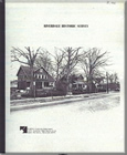
Riverdale Historic Survey

Title:
Riverdale Historic Survey
Author:
The Maryland-National Capital Park and Planning Commission
Prince George's County Planning Department
Publication Date:
07/01/1991
Source of Copies:
The Maryland-National Capital Park and Planning Commission
14741 Governor Oden Bowie Drive
Upper Marlboro, MD 20772
Number of Pages:
35
This report details the findings of a historical/architectural survey of the Town of Riverdale, requested by the Mayor and Town Council. The goal of the project was to document and analyze the age and architectural character of III residential buildings within the Town’s two older subdivisions. The report is divided into two primary sections: Background and methodology, and Findings. Background and Methodology includes a brief historical statement about the development of the area that became Riverdale ‘beginning with the establishment of the Riversdale Plantation in 1801, the rival of the Baltimore & Ohio Railroad in the 1830s and the sale of the plantation and the platting of Riverdale Park in the 1880s. It also includes n explanation of the project’s research methodology which involved a questionnaire to residents, the collection of archival tax assessment data, a comprehensive field survey, photography and the detailed analysis of a elected group of buildings. The section on Findings includes an expanded statement of the development and architectural character of the survey area in he twentieth century, a discussion of commonly found building forms and a apprehensive mapping of buildings by construction date and architectural arm. The report is supplemented with maps, plats, tables and photographs.

 Riverdale Historic Survey July 1991