Publications Directory
Approved Countywide Master Plan of Transportation

Title:
Approved Countywide Master Plan of Transportation
Author:
The Maryland-National Capital Park and Planning Commission
Publication Date:
11/01/2009
Source of Copies:
The Maryland-National Capital Park and Planning Commission
14741 Governor Oden Bowie Drive
Upper Marlboro, MD 20772
Number of Pages:
120
The Approved Countywide Master Plan of Transportation updates the earlier Prince George’s County Master Plan of Transportation, which was approved in 1982 and has since been updated by the transportation recommendations in 34 master and sector plans that have been adopted and approved since 1982. The plan was developed with the assistance of the citizens of Prince George’s County; elected officials; and state, regional and local government agencies. The plan’s goals, policies, and strategies seek to ensure an efficient multimodal transportation infrastructure in the county that accommodates the needs of all user groups. Amendments of this plan by future master and sector plans will be reflected on the Transportation Planning webpage.
Related Documents:
 Minor Plan Amendment
 Part 1 Executive Summary, Introduction and General Plan Context
 Part 2 Trails, Bikeways, and Pedestrian Mobility
 Part 3 Transit
 Part 4 Streets, Roads, and Highways
 Part 5 Strategic Transportation Policy and Master Plan Implementation
 Part 6 Maps
 Part 7 Bikeway and Trail Map
 Resolution
Approved Countywide Map Amendment for the Reserved Open Space (R-O-S) Zone in Prince George's County
Title:
Approved Countywide Map Amendment for the Reserved Open Space (R-O-S) Zone in Prince George's County
Author:
The Maryland-National Capital Park and Planning Commission
Prince George's County Planning Department
Publication Date:
05/01/1998
Source of Copies:
The Maryland-National Capital Park and Planning Commission
14741 Governor Oden Bowie Drive
Upper Marlboro, MD 20772
Number of Pages:
80
This document contains maps and supporting text identifying and explaining the Countywide Map Amendment (CMA) for the Reserved Open Space (R-O-S) Zone in Prince George’s County. Prepared by Planning Department staff with input from some public agencies, the CMA reclassifies certain large tracts of properties owned by public agencies into the R-O-S Zone. Information in this document is presented for Federal, State of Maryland, Prince George’s County Government, Prince George’s County Board of Education, Washington Suburban Sanitary Commission, The Maryland-National Capital Park and Planning Commission and municipal park properties. The R-O-S Zone was created by the District Council in 1994 by the passage of Council Bill, CB- 73-1994 and the Countywide Map Amendment was initiated by Council Resolution, CR- 7 -1996. The CMA was approved by Council Resolution CR-42-1998.
Approved Countywide Green Infrastructure Plan
Title:
Approved Countywide Green Infrastructure Plan
Author:
The Maryland-National Capital Park and Planning Commission
Prince George's County Planning Department
Publication Date:
06/01/2005
Source of Copies:
The Maryland-National Capital Park and Planning Commission
14741 Governor Oden Bowie Drive
Upper Marlboro, MD 20772
Number of Pages:
64
This document contains text and maps of the Approved Countywide Green Infrastructure Plan for Prince George’s County, Maryland. Green infrastructure is defined as an interconnected network of waterways, wetlands, woodlands, wildlife habitats, and other natural areas of countywide significance . The plan identifies a contiguous network of environmentally sensitive areas throughout the county and sets forth a goal, objectives, policies, and strategies to preserve, protect, and enhance these elements by the year 2025. The plan supports the desired development pattern in the General Plan. This is the first comprehensive functional master plan ever developed for environmental ecosystems in Prince George’s County.
Approved City of Mount Rainier Mixed-Use Town Center Zone Development Plan
Title:
Approved City of Mount Rainier Mixed-Use Town Center Zone Development Plan
Author:
The Maryland-National Capital Park and Planning Commission
Prince George's County Planning Department
Publication Date:
11/01/2010
Source of Copies:
The Maryland-National Capital Park and Planning Commission
14741 Governor Oden Bowie Drive
Upper Marlboro, MD 20772
Number of Pages:
212
The mixed-use town center (M-U-TC) zone district was created in 1994 to promote reinvestment and development in the county’s older, more established mixed-use areas. This document updates the July 1994 Mount Rainier Town Center Development Plan and revises the development policies and design standards and guidelines that will support a pedestrian-friendly, vibrant mixed-use town center for the City of Mount Rainier.
This plan was developed by M-NCPPC during an extensive 18-month public participation process that involved the input of many residents and public officials. The plan, which takes into account current market and economic conditions, consists of five sections: the Introduction, which defines the project area and outlines the public participation process; the Existing Conditions Analysis, which includes a historical overview and current economic and marketing considerations; the Plan Vision, which describes the envisioned future for the M-U-TC area; the Design Standards and Guidelines, which promote high-quality urban and architectural design; and the Implementation, which provides information on funding resources to encourage, promote, and facilitate near, medium, and long-term project goals.
Related Documents:
2010 Approved Central US 1 Corridor Sector Plan and Sectional Map Amendment
Title:
2010 Approved Central US 1 Corridor Sector Plan and Sectional Map Amendment
Author:
The Maryland-National Capital Park and Planning Commission
Prince George's County Planning Department
Publication Date:
06/01/2010
Source of Copies:
The Maryland-National Capital Park and Planning Commission
14741 Governor Oden Bowie Drive
Upper Marlboro, MD 20772
Number of Pages:
400
This sector plan updates the 2002 Approved College Park US 1 Corridor Sector Plan and Sectional Map Amendment and amends portions of the 1989 Approved Master Plan for Langley Park-College Park-Greenbelt and Vicinity and 1990 Adopted Sectional Map Amendment for Planning Areas 65, 66, and 67, and 2001 Approved Sector Plan and Sectional Map Amendment for the Greenbelt Metro Area. Developed with the active participation of the community, property owners, developers, residents, and elected officials, this document recommends goals, policies, strategies, and actions pertaining to land use, the environmental and green infrastructure networks, multimodal transportation system, public facilities, parks and recreation, historic preservation, economic development, zoning, and implementation. The plan builds upon the recommendations of the 2002 Prince George’s County Approved General Plan for corridors in the Developed and Developing Tiers, addresses sustainable development tied to existing and proposed mass transit options, and incorporates recommendations from functional area master plans, such as the Approved Countywide Green Infrastructure Plan, Countywide Master Plan of Transportation, and Water Resources Functional Master Plan. The sectional map amendment proposes zoning changes to implement the land use recommendations of the sector plan.
Related Documents:
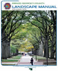
Prince George's County Landscape Manual
Title:
Prince George's County Landscape Manual
Author:
The Maryland-National Capital Park and Planning Commission
Prince George's County Planning Department
Publication Date:
12/01/2010
Source of Copies:
The Maryland-National Capital Park and Planning Commission
14741 Governor Oden Bowie Drive
Upper Marlboro, MD 20772
Number of Pages:
135
The purpose of the Prince George’s County Landscape Manual is to enhance the quality of life of county residents, the appearance of communities, and the overall environmental health of Prince George’s County by improving the design, sustainability, and quality of landscaping. Toward that end, the Landscape Manual set forth in one publication all of the regulations for landscaping, buffering, and screening that apply to public and private development in Prince George’s County. It established minimum mandatory standards, articulated design guidelines, provided options that allow greater creativity and flexibility in design, and established a procedure for approval of alternative methods of compliance with the standards.
Related Documents:
Prince George's County Industrial Land Needs and Employment Study
Title:
Prince George's County Industrial Land Needs and Employment Study
Author:
The Urban Studies and Planning Program, University of Maryland College Park, Maryland
Publication Date:
05/01/2010
Source of Copies:
The Maryland-National Capital Park and Planning Commission
14741 Governor Oden Bowie Drive
Upper Marlboro, MD 20772
Number of Pages:
357
This study assesses county industrial employment, land-use patterns, and real estate market trends; explores the fiscal and economic impacts of industrial land use and employment; and includes an inventory and analysis of industrial and warehouse space in the county for 2009. The study provides essential information to support ongoing and future planning decisions regarding the designation and supply of industrial land to meet projected future demand.
Related Documents:
Prince George's County High-End Retail Market Analysis

Title:
Prince George's County High-End Retail Market Analysis
Author:
The Maryland-National Capital Park and Planning Commission
Prince George's County Planning Department
Publication Date:
05/01/2016
Source of Copies:
The Maryland-National Capital Park and Planning Commission
14741 Governor Oden Bowie Drive
Upper Marlboro, MD 20772
Number of Pages:
30
Local developers and brokers report that retail in the County is on an upward trajectory, with positive perceptions of developments underway at Riverdale Park Station, National Harbor, Hyattsville Arts District, and around University of Maryland (UMD) in College Park. The Prince Georges County High-End Retail Market Analysis provides an assessment of high-end retail market trends and identifies opportunities for Prince Georges County to attract luxury retailers. Furthermore, the report identifies growth opportunities at existing high-end shopping centers and discusses the potential for creating new destinations for high-end retail in the County.
Related Documents:
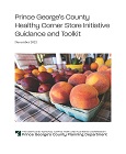
Prince George's County Healthy Corner Store Initiative Guidance and Toolkit
Title:
Prince George's County Healthy Corner Store Initiative Guidance and Toolkit
Author:
The Maryland-National Capital Park and Planning Commission
Prince George's County Planning Department
Publication Date:
12/01/2022
Source of Copies:
The Maryland-National Capital Park and Planning Commission
14741 Governor Oden Bowie Drive
Upper Marlboro, MD 20772
Number of Pages:
50
Prepared for the Institute for Public Health Innovation in coordination with the Prince George’s County Health Department, this document consists of an in-depth profile of existing conditions for small corner stores in the Healthy Food Priority Areas of Prince George’s County. Retail market conditions and data are analyzed, case studies are examined, and guidance and recommendations for the implementation of the Healthy Corner Store Initiative (HCSI) are provided. A user-friendly toolkit is included to help store owners offer fresh, healthy food items.
Related Documents:
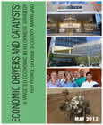
Prince George's County Economic Development Strategic Plan-The Economic Drivers and Catalysts: A Targeted Economic Development Strategy for Prince George's County, Maryland
Title:
Prince George's County Economic Development Strategic Plan-The Economic Drivers and Catalysts: A Targeted Economic Development Strategy for Prince George's County, Maryland
Author:
The Maryland-National Capital Park and Planning Commission
Prince George's County Planning Department
Publication Date:
05/01/2013
Source of Copies:
The Maryland-National Capital Park and Planning Commission
14741 Governor Oden Bowie Drive
Upper Marlboro, MD 20772
Number of Pages:
92
This report presents the results of a year-long effort to create a targeted economic development strategy that will maximize the generation of new jobs in Prince Georges County and diversify and grow the tax base that supports the countys government services and quality of life.