Publications Directory
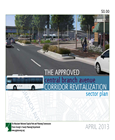
2013 Approved Central Branch Avenue Corridor Revitalization Sector Plan
Title:
2013 Approved Central Branch Avenue Corridor Revitalization Sector Plan
Author:
The Maryland-National Capital Park and Planning Commission
Prince George's County Planning Department
Publication Date:
04/01/2013
Source of Copies:
The Maryland-National Capital Park and Planning Commission
14741 Governor Oden Bowie Drive
Upper Marlboro, MD 20772
Number of Pages:
158
The sector plan amends portions of the 2000 Approved Master Plan and Sectional Map Amendment for the Heights and Vicinity (Planning Area 76A), 2006 Approved Master Plan and Sectional Map Amendment for the Henson Creek-South Potomac Planning Area, 2008 Approved Branch Avenue Corridor Sector Plan and Sectional Map Amendment, and 1993 Approved Subregion 5 Master Plan and Sectional Map Amendment. This sector plan builds on the opportunities for growth and revitalization within communities along the Central Branch Avenue Corridor created by the potential future growth at Joint Base Andrews, the planned expansion of Southern Maryland Hospital, and the planned fixed guideway transit line along MD 5. These events, coupled with plans for transit-oriented development at the Branch Avenue Metro Station, create opportunities to reposition key commercial and employment centers and offer a broader range of housing options. The sector plan highlights these and other key opportunities and constraints. It presents redevelopment programs to guide future growth and revitalization at future transit nodes and within suburban strip shopping centers in six focus areas along Branch Avenue and the Allentown, Suitland, and St. Barnabas Road commercial corridors. Developed with extensive public participation, this document presents background information; plan goals; focus area visions and recommendations pertaining to land use, future zoning, development programs, and concepts; corridorwide recommendations for land use, community design, the environment, transportation, recreation and parks, schools, and historic preservation; and implementation strategies.
Related Documents:
Technical Summary for the Preliminary General Plan: Infrastructure, Transportation, Public Facilities
Title:
Technical Summary for the Preliminary General Plan: Infrastructure, Transportation, Public Facilities
Author:
The Maryland-National Capital Park and Planning Commission
Prince George's County Planning Department
Publication Date:
02/01/2002
Source of Copies:
The Maryland-National Capital Park and Planning Commission
14741 Governor Oden Bowie Drive
Upper Marlboro, MD 20772
Number of Pages:
86
The Technical Summary for the Preliminary General Plan: Infrastructure, Transportation, Public Facilities provides background information in support of the 2002 Preliminary General Plan for Prince George’s County. This information, based on staff and consultant analyses, helped guide the Prince George’s County Planning Department in making recommendations contained in the Preliminary General Plan and will also be used in the preparation of future plans. The report is divided into three parts. The Environment Infrastructure section describes background information and analyses for green infrastructure, woodland conservation, water quality, energy efficiency, green building, and outdoor lighting. The Transportation section describes the transportation model used to analyzed the mid-range (2005) impacts of the Preferred Development Alternative upon which the Preliminary Plan’s recommendations are based. The general implications of the model results are also discussed. The Public Facilities section describes background analyzed for schools, fire and rescue, police, and library facilities. These analyses were used to make Preliminary General Plan recommendations for fire and rescue facilities, as well as establishing objectives for libraries and police facilities. The school facilities analysis included in this document projects mid-range (2005) school (elementary, middle, and high) seats needed within large sections of the county.
Document not available for download.
Technical Report: A Study of Occupational Shifts and Workforce Characteristics for Prince George's County
Title:
Technical Report: A Study of Occupational Shifts and Workforce Characteristics for Prince George's County
Author:
Battelle Technology Partnership Practice together with the Jacob France Institute at the University of Baltimore and Market-Economics, Inc.
Publication Date:
12/01/2011
Source of Copies:
The Maryland-National Capital Park and Planning Commission
14741 Governor Oden Bowie Drive
Upper Marlboro, MD 20772
Number of Pages:
87
This report serves as the Technical Report to the Study of Occupational Shifts and Workforce Characteristics in Prince George’s County prepared for the Prince George’s County Planning Department of the Maryland-National Capital Park and Planning Commission (M-NCPPC). This Technical Report provides a more detailed analysis of the quantitative and qualitative findings that are the underpinnings of the results of the study. The objective of the study is to provide policy/decision makers with a better understanding of occupational changes and workforce development needs, and to develop a strategy to meet these needs and promote regional growth and business development. This calls for a comprehensive assessment of the expected future workforce demands from likely industry drivers and a rigorous analysis of the county’s capacity to meet these future needs.
Technical Data Base Study Western Branch Watershed, Prince George's County, Maryland

Title:
Technical Data Base Study Western Branch Watershed, Prince George's County, Maryland
Author:
The Prince George's County Stormwater Management Technical Group
Publication Date:
01/01/1981
Source of Copies:
The Maryland-National Capital Park and Planning Commission
14741 Governor Oden Bowie Drive
Upper Marlboro, MD 20772
Number of Pages:
126
This report contains the hydrologic, hydraulic and environmental features data generated during the study. Survey and other pertinent background information are on file in the Enviromental Planning Division of the Maryland-National Capital Park and Planning Commission, County Administration Building, Upper Marlboro, Maryland.
Related Documents:
Takoma/Langley Crossroads Planning and Implementation Study

Title:
Takoma/Langley Crossroads Planning and Implementation Study
Author:
The Maryland-National Capital Park and Planning Commission
Prince George's County Planning Department
Publication Date:
11/01/2021
Source of Copies:
The Maryland-National Capital Park and Planning Commission
Prince George's County Planning Department
1616 McCormick Drive
Largo, MD 20774
Number of Pages:
72
The Maryland-National Capital Park and Planning Commission (M-NCPPC) engaged HR&A Advisors, Inc. and Toole Design to identify opportunities for transit-oriented development (TOD) in Takoma/Langley Crossroads. With the anticipated delivery of the Purple Line and the initiation of the Countywide Map Amendment process, M-NCPPC is interested in developing implementation tools and strategies to support denser, mixed-use, and walkable development in the study area, while also preserving the racial and ethnic diversity of the local community. The findings and recommendations within this study are not intended to be prescriptive; additional analysis is necessary to assess the financial feasibility and equity impacts of TOD in Takoma/Langley Crossroads.
Related Documents:
Summary Prince George's County Approved General Plan
Title:
Summary Prince George's County Approved General Plan
Author:
The Maryland-National Capital Park and Planning Commission
Prince George's County Planning Department
Publication Date:
10/01/2002
Source of Copies:
The Maryland-National Capital Park and Planning Commission
14741 Governor Oden Bowie Drive
Upper Marlboro, MD 20772
Number of Pages:
120
The Prince George’s County District Council approved the 2002 Prince George’s County General Plan on October 7, 2002. The purpose of the General Plan is to provide broad strategies to guide the future growth and development of the county, while providing for environmental protection and preservation of important lands. The General Plan represents the results of an evolving definition of growth policies for the county. It is the culmination of the current phase of an ongoing process to define the future of Prince George’s County. It builds on the recommendation of the adopted 2000 Biennial Growth Policy Plan. This summary highlights the General Plan’s proposals.
Summary and Analysis of Residential Development PA & PAZ January 1975 - June 1978
Title:
Summary and Analysis of Residential Development PA & PAZ January 1975 - June 1978
Author:
The Maryland-National Capital Park and Planning Commission
Prince George's County Planning Department
Publication Date:
02/01/1979
Source of Copies:
The Maryland-National Capital Park and Planning Commission
14741 Governor Oden Bowie Drive
Upper Marlboro, MD 20772
Number of Pages:
59
This report coordinates, simplifies and analyzes the data coming from complex subdivision process in Prince Georges County, Maryland. This automated approach to compiling subdivision data is designed to assist the public and private sectors of land use planners, developers, market researchers, and policy decision makers in making more accurate and timely forecasts of future development.
Document not available for download.
Suitland Metro Station and Silver Hill TNI Pedestrian Accessibility Study

Title:
Suitland Metro Station and Silver Hill TNI Pedestrian Accessibility Study
Author:
A. Morton Thomas and Associates, Inc. for The Maryland-National Capital Park an d Planning Commission
Publication Date:
01/01/2020
Source of Copies:
The Maryland-National Capital Park and Planning Commission
14741 Governor Oden Bowie Drive
Upper Marlboro, MD 20772
Number of Pages:
68
The Suitland Metro Station and Silver Hill TNI Pedestrian Accessibility Study report provides an assessment of the pedestrian infrastructure within the Suitland Metro Station and Silver Hill TNI area and expands on the pedestrian improvement recommendations of the 2014 Approved Southern Green Line Area Sector Plan and Sectional Map Amendment. The report reflects a collaborative effort between community stakeholders input and governmental entities that focuses on the implementation of complete streets policies where possible and recommendations to improve pedestrian mobility/connectivity and safety throughout the study area.
Related Documents:
Subdivision Cross Reference Listings January 1975 - June 1978
Title:
Subdivision Cross Reference Listings January 1975 - June 1978
Author:
The Maryland-National Capital Park and Planning Commission
Prince George's County Planning Department
Publication Date:
01/01/1977
Source of Copies:
The Maryland-National Capital Park and Planning Commission
14741 Governor Oden Bowie Drive
Upper Marlboro, MD 20772
Number of Pages:
132
The following reports are formatted for only one geographic unit the planning area. The report of time spans the year January 1, 1975 to July 1, 1978. Each report covers one calendar year and gives information on Preliminary Plans of Subdivision submitted, Preliminary Plans of Subdivision approved by the Prince Georges County Planning Board, and Plats of Subdivision recorded in the Office of Lan Records of Prince Georges County.
Document not available for download.
Subdivision Activity 1977
Title:
Subdivision Activity 1977
Author:
The Maryland-National Capital Park and Planning Commission
Prince George's County Planning Department
Publication Date:
01/01/1977
Source of Copies:
The Maryland-National Capital Park and Planning Commission
14741 Governor Oden Bowie Drive
Upper Marlboro, MD 20772
Number of Pages:
142
The following reports are formatted for only one geographic unit the planning area. The report of time spans the year January 1, 1975 to July 1, 1978. Each report covers one calendar year and gives information on Preliminary Plans of Subdivision submitted, Preliminary Plans of Subdivision approved by the Prince Georges County Planning Board, and Plats of Subdivision recorded in the Office of Lan Records of Prince Georges County.
 Central Branch Avenue