Publications
Image Carousel


Publications Information
Upper Marlboro Town Action Plan

Title:
Upper Marlboro Town Action Plan
Author:
The Maryland-National Capital Park and Planning Commission
Prince George's County Planning Department
Publication Date:
09/01/2009
Source of Copies:
The Maryland-National Capital Park and Planning Commission
14741 Governor Oden Bowie Drive
Upper Marlboro, MD 20772
Number of Pages:
200
The Upper Marlboro Town Action Plan comprises text, maps, illustrations, and pictures. Developed with broad public participation, including a citizen’s advisory committee in addition to outreach to the general citizens and business community, this document presents background information and recommends goals, strategies, and action pertaining to land use, parks and recreation, transportation, trails, public facilities, historic preservation.
Related Documents:
 A-Front Matter
B-Introduction
C-Listening and Examining
D-Population Land Use and Zoning
E-Urban Design and the Public Realm
F-Urban Design Continued
G-Transportation and Infrastructure
H-Historic Preservation
I-Economic Development
J-Economic Development Continued
K-Public Finance and Intergovernmental Coordination
L-Implementation Strategies
M-Conclusion
N-Appendix 1
O-Appendix 2
P-Appendix 3
Q-Appendix 4
R-Appendix 5
S-Appendix 6
A-Front Matter
B-Introduction
C-Listening and Examining
D-Population Land Use and Zoning
E-Urban Design and the Public Realm
F-Urban Design Continued
G-Transportation and Infrastructure
H-Historic Preservation
I-Economic Development
J-Economic Development Continued
K-Public Finance and Intergovernmental Coordination
L-Implementation Strategies
M-Conclusion
N-Appendix 1
O-Appendix 2
P-Appendix 3
Q-Appendix 4
R-Appendix 5
S-Appendix 6
Glenarden: The Past in Perspective

Title:
Glenarden: The Past in Perspective
Author:
The Maryland-National Capital Park and Planning Commission
Prince George's County Planning Department
Publication Date:
10/01/1995
Source of Copies:
The Maryland-National Capital Park and Planning Commission
14741 Governor Oden Bowie Drive
Upper Marlboro, MD 20772
Number of Pages:
29
This report summarizes the history and development of the Town of Glenarden, the forms a companion piece to the marketing quested by the municipality. It was produced by the Historic Preservation Section of Department through the Planning Assistance to Municipalities and Communities which produced the marketing brochure. The report consists of a brief history of the Glenarden community, beginning with construction of the Washington, Baltimore and electric railroad in 1908, and the subdivisions which followed in 1911 and 1913. It explains the beginnings of Glenarden in the context of other African-American communities developing during the same period, and gives a demographic profile of the new community in 1920. The report is supplemented by plats dating from 1940, as well as a transcription of Population Census for Glenarden in 1920.
Related Documents:
General Plan Growth Policy Update Prince George's County
Title:
General Plan Growth Policy Update Prince George's County
Author:
The Maryland-National Capital Park and Planning Commission
Prince George's County Planning Department
Publication Date:
09/01/2008
Source of Copies:
The Maryland-National Capital Park and Planning Commission
14741 Governor Oden Bowie Drive
Upper Marlboro, MD 20772
Number of Pages:
47
The General Plan Growth Policy Update is a progress report on the implementation of the 2002 Prince George’s County Approved General Plan. In 2000, Prince George’s County adopted the Biennial Growth Policy Plan, which helps keep policies up-to-date and implementation efforts on track. This report is the second Growth Policy Update completed since the approval of the 2002 General Plan. It contains a Highlights section that summarizes the progress for each General Plan Element. The Monitoring Progress section shows in detail how well the county is meeting the measurable objectives contained in the General Plan objectives. The Appendix provides a brief description of planning projects and studies that support the General Plan and have been completed, are underway, or are in the preplanning stage.
Related Documents:
Transportation Review Guidelines, Part 2 2013
Title:
Transportation Review Guidelines, Part 2 2013
Author:
The Maryland-National Capital Park and Planning Commission
Prince George's County Planning Department
Publication Date:
05/01/2013
Source of Copies:
The Maryland-National Capital Park and Planning Commission
14741 Governor Oden Bowie Drive
Upper Marlboro, MD 20772
Number of Pages:
86
Draft guidelines for evaluating the adequacy of bicycle and pedestrian facilities in Centers and Corridors consistent with CB-2-2012 and the 2009 Approved Countywide Master Plan of Transportation.
Related Documents:
Transportation Review Guidelines, Part 1 2012
Title:
Transportation Review Guidelines, Part 1 2012
Author:
The Maryland-National Capital Park and Planning Commission
Publication Date:
11/01/2012
Source of Copies:
The Maryland-National Capital Park and Planning Commission
14741 Governor Oden Bowie Drive
Upper Marlboro, MD 20772
Number of Pages:
102
The primary purpose of this document is to provide the technical standards for the evaluation of the adequacy of transportation facilities by the Prince George’s County Planning Board. Secondarily, it documents a number of processes and procedures used to review development plans as well as master, sector, and small area plans. The Guidelines establish criteria by which staff and applicants with land development proposals can assess the traffic impact and transportation issues related to development proposals. They also indicate the manner in which information will be presented to the Planning Board. Section 1 of these Guidelines describes the process of gathering existing data and submitting studies; it also include a glossary of transportation terms. Section 2 summarizes study requirements for the various types of applications. Section 3 details the methodology to be used in performing the traffic study. Sections 4 through 6 describe the use of a system of trip credits related to design as well as off-site transit, pedestrian, and bicycle facilities. Section 7 documents a number of transportation modeling procedures and their use in the analysis of plans. Section 8 includes the County Council’s Guidelines for Mitigation Actions. Section 9 specifies several processes in plan review outside of the review of traffic impact studies. Section 10 denotes the implementation and applicability of these Guidelines. A future Part 2 will be prepared no later than June 1, 2013 to guide the determination of findings related to Section 24-124.01 of the Subdivision Regulations.
Related Documents:
Town of Upper Marlboro Design Guidelines

Title:
Town of Upper Marlboro Design Guidelines
Author:
The Maryland-National Capital Park and Planning Commission
Prince George's County Planning Department
Publication Date:
12/01/2014
Source of Copies:
The Maryland-National Capital Park and Planning Commission
14741 Governor Oden Bowie Drive
Upper Marlboro, MD 20772
Number of Pages:
40
This document updates the 1981 Upper Marlboro Design Guidelines and refines ur ban design and public realm design recommendations from the 2009 Upper Marlboro Town Action Plan. The written and graphic design guidelines of this pattern book are intended to create a shared vision for the physical form of the t own core buildings and the public realm. This document is meant to be used as a reference manual in making public, private, and non-profit development decisions involving new construction, additions, alterations, renovations, restoration, signs, street furniture, and landscaping.
Related Documents:
Town of Edmonston Economic Development Strategy

Title:
Town of Edmonston Economic Development Strategy
Author:
The Maryland-National Capital Park and Planning Commission
Publication Date:
05/01/2023
Source of Copies:
The Maryland-National Capital Park and Planning Commission
14741 Governor Oden Bowie Drive
Upper Marlboro, MD 20772
Number of Pages:
58
This document is an Economic Development Strategy for the Town of Edmonston, a small municipality in northern Prince George’s County, Maryland, incorporated in 1924 (Planning Area 68, Councilmanic District 5). The strategy combines demographic, economic, and real estate data in a SWOT Analysis; a community-crafted economic development vision statement, four supporting community economic development goals, and 12 action items in four priority areas for the town to implement.
Related Documents:
Forestville TNI Area Pedestrian Accessibility Study

Title:
Forestville TNI Area Pedestrian Accessibility Study
Author:
A. Morton Thomas and Associates, Inc. for The Maryland-National Capital Park and Planning Commission
Publication Date:
01/01/2020
Source of Copies:
The Maryland-National Capital Park and Planning Commission
14741 Governor Oden Bowie Drive
Upper Marlboro, MD 20772
Number of Pages:
76
The Forestville TNI Area Pedestrian Accessibility Study report provides an assessment of the pedestrian infrastructure within the Forestville TNI area and expands on the pedestrian improvement recommendations of the 2010 Approved Subregion 4 Master Plan and Sectional Map Amendment. The report reflects a collaborative effort between community stakeholders input and governmental entities that focuses on the implementation of policies and recommendations to improve pedestrian mobility/connectivity and safety throughout the study area.
Related Documents:
The Village of Brandywine Sidewalk and Streetscape Improvements Study: 30% Design and Engineering Report
Title:
The Village of Brandywine Sidewalk and Streetscape Improvements Study: 30% Design and Engineering Report
Author:
The Maryland-National Capital Park and Planning Commission
Prince George's County Planning Department
Publication Date:
10/01/2021
Source of Copies:
The Maryland-National Capital Park and Planning Commission
14741 Governor Oden Bowie Drive
Upper Marlboro, MD 20772
Number of Pages:
108
This report describes the goals, considerations, and recommendations for the 30% preliminary design and engineering plans and construction cost estimate developed for the Brandywine Sidewalk & Streetscape Improvements Project. This project was funded through the Planning Assistance to Municipalities and Communities (PAMC) Program administered by the Prince George’s County Planning Department.
Related Documents:
The Southern Avenue Metro Station Area Pedestrian Accessibility Study
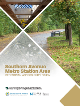
Title:
The Southern Avenue Metro Station Area Pedestrian Accessibility Study
Author:
The Maryland-National Capital Park and Planning Commission
Prince George's County Planning Department
Publication Date:
12/01/2023
Source of Copies:
The Maryland-National Capital Park and Planning Commission
1616 McCormick Drive
Largo, MD 20774
Number of Pages:
82
This report is an evaluation of the pedestrian, bicycle, and safety conditions around the Southern Avenue and Naylor Road Metro Station areas. The report was developed through a process of identifying challenges and opportunities associated with the station areas. The findings and recommendations presented in this report do not necessarily represent the official policy positions of any members of the Maryland-National Capital Park and Planning Commission (M-NCPPC) and should not be read as such.
Related Documents: