Publications
Image Carousel


Publications Information
The Prince George's County Public Facilities Needs Assessment Study
Title:
The Prince George's County Public Facilities Needs Assessment Study
Author:
The Maryland-National Capital Park and Planning Commission
Prince George's County Planning Department
Publication Date:
05/01/2013
Source of Copies:
The Maryland-National Capital Park and Planning Commission
14741 Governor Oden Bowie Drive
Upper Marlboro, MD 20772
Number of Pages:
58
As background information for the General Plan Update, Plan Prince George’s 2035, this Public Facilities Needs Assessment (PFNA) will inventory existing public facilities within Prince George’s County. It will include public libraries, fire and emergency medical services stations, public schools, county police district stations, a sheriff facility, park and recreation facilities, and park police facilities.
Related Documents:
 Public Facilities Needs Assessment Study May 2013
The Houses of Fairmount Heights, Maryland: A Pattern Book
Title:
The Houses of Fairmount Heights, Maryland: A Pattern Book
Author:
The Maryland-National Capital Park and Planning Commission
Prince George's County Planning Department
Publication Date:
03/01/2022
Source of Copies:
The Maryland-National Capital Park and Planning Commission
14741 Governor Oden Bowie Drive
Upper Marlboro, MD 20772
Number of Pages:
142
This pattern book is part of an FY 2019 and FY 2020 M-NCPPC Planning Assistance to Municipalities and Communities (PAMC) Program project requested by the Town of Fairmount Heights to update the 1993 Fairmount Heights, Maryland Residential Façade and Improvement Guidelines. It identifies over 500 single-family dwellings, classifies and maps them by style and dates of construction, explains the origins and characteristics of each style, provides photographs, and in certain instances provides new research on the early builders and homeowners. It identifies vacant properties in the town and provides five new dwelling designs that are compatible with the existing dwellings and streetscape. It is a companion to the 1993 Fairmount Heights, Maryland Residential Façade and Improvement Guidelines publication which is being reprinted.
Related Documents:
The Future of Agriculture in Prince George's County, Maryland
Title:
The Future of Agriculture in Prince George's County, Maryland
Author:
The Maryland-National Capital Park and Planning Commission
Prince George's County Planning Department
Publication Date:
05/01/2005
Source of Copies:
The Maryland-National Capital Park and Planning Commission
14741 Governor Oden Bowie Drive
Upper Marlboro, MD 20772
Number of Pages:
52
This document describes the transformation of agriculture and its potential in Prince George’s County. After a brief overview and myths and facts about the county’s agriculture, it portrays the characteristics of farms and farmland. The report provides information on farmland protection and profitable farming and lists opportunities for diversifying and marketing strategies for farmers. Following a discussion on challenges and benefits of farming at the urban edge, the report concludes with recommendations to transform agriculture into a viable industry. in Prince George’s County. After a brief overview and myths and facts about the county’s agriculture, it portrays the characteristics of farms and farmland. The report provides information on farmland protection and profitable farming and lists opportunities for diversifying and marketing strategies for farmers. Following a discussion on challenges and benefits of farming at the urban edge, the report concludes with recommendations to transform agriculture into a viable industry.
Technical Data Base Study Western Branch Watershed, Prince George's County, Maryland

Title:
Technical Data Base Study Western Branch Watershed, Prince George's County, Maryland
Author:
The Prince George's County Stormwater Management Technical Group
Publication Date:
01/01/1981
Source of Copies:
The Maryland-National Capital Park and Planning Commission
14741 Governor Oden Bowie Drive
Upper Marlboro, MD 20772
Number of Pages:
126
This report contains the hydrologic, hydraulic and environmental features data generated during the study. Survey and other pertinent background information are on file in the Enviromental Planning Division of the Maryland-National Capital Park and Planning Commission, County Administration Building, Upper Marlboro, Maryland.
Related Documents:
Takoma/Langley Crossroads Planning and Implementation Study
Title:
Takoma/Langley Crossroads Planning and Implementation Study
Author:
The Maryland-National Capital Park and Planning Commission
Prince George's County Planning Department
Publication Date:
11/01/2021
Source of Copies:
The Maryland-National Capital Park and Planning Commission
Prince George's County Planning Department
1616 McCormick Drive
Largo, MD 20774
Number of Pages:
72
The Maryland-National Capital Park and Planning Commission (M-NCPPC) engaged HR&A Advisors, Inc. and Toole Design to identify opportunities for transit-oriented development (TOD) in Takoma/Langley Crossroads. With the anticipated delivery of the Purple Line and the initiation of the Countywide Map Amendment process, M-NCPPC is interested in developing implementation tools and strategies to support denser, mixed-use, and walkable development in the study area, while also preserving the racial and ethnic diversity of the local community. The findings and recommendations within this study are not intended to be prescriptive; additional analysis is necessary to assess the financial feasibility and equity impacts of TOD in Takoma/Langley Crossroads.
Related Documents:
Suitland Metro Station and Silver Hill TNI Pedestrian Accessibility Study

Title:
Suitland Metro Station and Silver Hill TNI Pedestrian Accessibility Study
Author:
A. Morton Thomas and Associates, Inc. for The Maryland-National Capital Park an d Planning Commission
Publication Date:
01/01/2020
Source of Copies:
The Maryland-National Capital Park and Planning Commission
14741 Governor Oden Bowie Drive
Upper Marlboro, MD 20772
Number of Pages:
68
The Suitland Metro Station and Silver Hill TNI Pedestrian Accessibility Study report provides an assessment of the pedestrian infrastructure within the Suitland Metro Station and Silver Hill TNI area and expands on the pedestrian improvement recommendations of the 2014 Approved Southern Green Line Area Sector Plan and Sectional Map Amendment. The report reflects a collaborative effort between community stakeholders input and governmental entities that focuses on the implementation of complete streets policies where possible and recommendations to improve pedestrian mobility/connectivity and safety throughout the study area.
Related Documents:
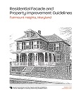
Fairmount Heights Residential Facade and Property Improvement Guidelines
Title:
Fairmount Heights Residential Facade and Property Improvement Guidelines
Author:
The Maryland-National Capital Park and Planning Commission
Prince George's County Planning Department
Publication Date:
08/01/1993
Source of Copies:
The Maryland-National Capital Park and Planning Commission
14741 Governor Oden Bowie Drive
Upper Marlboro, MD 20772
Number of Pages:
86
This project is part of FY 1991 M-NCPPC Planning Assistance to Municipalities and Communities Program requested by the Town of Fairmount Heights. It provides guidelines for use by homeowners and builders who plan to make exterior repairs or new home construction that are visible from the public right-of-way. The text establishes the importance of guidelines in preserving the historic character of the Town. It also includes a brief history of Fairmount Heights, the importance of the total streetscape and its relationship with infill construction, facade details including appropriate and in-appropriate examples, case studies of rehabilitation preserving/destroying original character, landscaping examples and appropriate plant materials, and possible funding sources.
Related Documents:
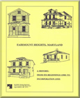
Fairmount Heights - A History: From Its Beginnings (1900) to Incorporation (1935)
Title:
Fairmount Heights - A History: From Its Beginnings (1900) to Incorporation (1935)
Author:
The Maryland-National Capital Park and Planning Commission
Prince George's County Planning Department
Publication Date:
07/01/1991
Source of Copies:
The Maryland-National Capital Park and Planning Commission
14741 Governor Oden Bowie Drive
Upper Marlboro, MD 20772
Number of Pages:
45
This report summarizes the findings of an architectural/historical survey of Fairmount Heights, requested by the Mayor and Council of the Town. The goal of the project was to prepare a history of the development of the community from its earliest subdivision in 1900. The report describes the sequential platting, between 1900 and 1923, of the six subdivisions which make up the present-day municipality; it describes the building of some of the earliest homes, and the establishment of community institutions such as schools, churches, the social hall and citizens associations. It analyzes and compares the architectural forms of the residential buildings, and describes the community in 1935 as it achieved incorporation, at that time the largest black municipality in Prince George’s County. The report is supplemented by photographs, plats and maps.
Document not available for download.
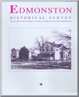
Edmonston Historical Survey
Title:
Edmonston Historical Survey
Author:
The Maryland-National Capital Park and Planning Commission
Prince George's County Planning Department
Publication Date:
07/01/1993
Source of Copies:
The Maryland-National Capital Park and Planning Commission
14741 Governor Oden Bowie Drive
Upper Marlboro, MD 20772
Number of Pages:
68
This report summarizes the findings of an historical/architectural survey of Edmonston, requested by the Mayor and Council of the Town. The goals of the project were to document the earliest of the historic buildings still standing in the Town, and to prepare a written history of the community’s development. The Town of Edmonston is located outside of the northeast boundary of the District of Columbia; it lies on the southeast side of the Baltimore and Ohio Railroad, bounded by Hyattsville on the west, Riverdale on the north and east, and Bladensburg on the south. Development of the community began around 1900 on land platted by J. Harris Rogers of Hyattsville, and shortly afterwards on adjoining land called “Palestine Farm” by Dr. Charles A. Wells. The first residents were families attracted to the area by the easily accessible transportation to and from work in Washington, D.C., offered by the Baltimore and Ohio Railroad and the City and Suburban streetcar line. The community was incorporated in 1924 as the Town of Edmonston. The report is divided into five major sections: Pre-Subdivision History, The Rogers and Wells Subdivisions, Growth and Development of East Hyattsville, Continued Development and After Incorporation. The report includes background history on the earliest development of the community, and the first subdivisions by Rogers and Wells; it also describes the settling of the first families in the newly platted subdivisions. It describes and compares the first dwellings erected in the community, and analyzes by building type a representative group of dwellings which survive from the first building period It then describes the community’s development as it approached incorporation in 1924. The report is supplemented by photographs, plats and maps.
Related Documents:
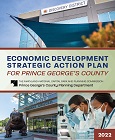
Economic Development Strategic Action Plan For Prince George's County
Title:
Economic Development Strategic Action Plan For Prince George's County
Author:
The Maryland-National Capital Park and Planning Commission
Prince George's County Planning Department
Publication Date:
03/01/2022
Source of Copies:
The Maryland-National Capital Park and Planning Commission
14741 Governor Oden Bowie Drive
Upper Marlboro, MD 20772
Number of Pages:
128
This report presents the results of a year-long effort to update the 2013 Economic Drivers and Catalysts: A Targeted Economic Development Strategy for Prince George’s County. This updated strategy seeks to build on the County’s success in promoting economic and employment development and provides recommendations on how to create high-quality jobs in Prince George’s County, diversify and grow the County’s tax base, and help support improved quality of life for County residents.
Related Documents: