Publications
Image Carousel


Publications Information
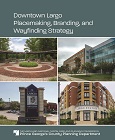
Downtown Largo Placemaking, Branding, and Wayfinding Strategy
Title:
Downtown Largo Placemaking, Branding, and Wayfinding Strategy
Author:
The Maryland-National Capital Park and Planning Commission
Prince George's County Planning Department
Publication Date:
05/01/2023
Source of Copies:
The Maryland-National Capital Park and Planning Commission
Prince George's County Planning Department
1616 McCormick Drive
Largo, MD 20774
Number of Pages:
103
The strategy makes recommendations for locations in Downtown Largo to be activated through various means of placemaking. Further, through community engagement, the strategy proposes a ‘brand’ for Largo and explores wayfinding options to improve walkability and increase a sense of place in Downtown Largo.
Related Documents:
 Largo Placemaking_WEB
East Hyattsville Architectural Survey

Title:
East Hyattsville Architectural Survey
Author:
The Maryland-National Capital Park and Planning Commission
Prince George's County Planning Department
Publication Date:
01/01/1998
Source of Copies:
The Maryland-National Capital Park and Planning Commission
14741 Governor Oden Bowie Drive
Upper Marlboro, MD 20772
Number of Pages:
72
This survey report was completed at the request of the City of Hyattsville and the Hyattsville Preservation Association under the Planning Assistance to Municipalities and Communities program. The purpose of the survey was to collect general data about the architectural and historical character of the areas known as East Hyattsville, North Hyattsville and Evansville surrounding the Hyattsville National Register Historic District. The survey also resulted in preliminary findings about the potential for expansion of the National Register historic district. The report contains general historic background, a general architectural description, recommendations on potential historic district expansion, and potential actions to follow. The report’s appendices include sample architectural survey forms, a detailed building inventory, a glossary of building forms and styles, and the Historic Preservation Commission’s Evaluation Criteria, Policies and Guidelines. The report is illustrated with maps and photographs.
Related Documents:
Developing a Neighborhood Planning Academy for Prince George's County

Title:
Developing a Neighborhood Planning Academy for Prince George's County
Author:
The Maryland-National Capital Park and Planning Commission
Prince George's County Planning Department
Publication Date:
04/01/2023
Source of Copies:
The Maryland-National Capital Park and Planning Commission
14741 Governor Oden Bowie Drive
Upper Marlboro, MD 20772
Number of Pages:
52
In December 2020, the Prince George’s County Planning Department developed an exploratory team to research and design a Neighborhood Planning Academy for Prince George’s County. Neighborhood Planning Academies are increasingly becoming a pillar of equitable community engagement practice and support civic education. From February to April 2021, the exploratory team conducted in-depth research pertaining to existing stakeholder knowledge about Urban Planning and local government and performed a comprehensive review of the Department’s civic educational activities. This document is a summary of the team’s key findings. This study also provides a recommendation for the program design of a Neighborhood Planning Academy for Prince George’s County.
Related Documents:
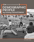
Demographic Profile by County Council District
Title:
Demographic Profile by County Council District
Author:
The Maryland-National Capital Park and Planning Commission
Publication Date:
10/01/2022
Source of Copies:
The Maryland-National Capital Park and Planning Commission
14741 Governor Oden Bowie Drive
Upper Marlboro, MD 20772
Number of Pages:
36
This report summarizes general and socioeconomic characteristics of population and housing for all nine 2022 County Council Districts in Prince George’s County.
Related Documents:
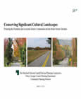
Conserving Significant Cultural Landscapes: Protecting the Piscataway and Accokeek Historic Communities and the Mount Vernon Viewshed
Title:
Conserving Significant Cultural Landscapes: Protecting the Piscataway and Accokeek Historic Communities and the Mount Vernon Viewshed
Author:
The Maryland-National Capital Park and Planning Commission
Prince George's County Planning Department
Publication Date:
03/01/2013
Source of Copies:
The Maryland-National Capital Park and Planning Commission
14741 Governor Oden Bowie Drive
Upper Marlboro, MD 20772
Number of Pages:
51
This study provides recommendations for conserving the cultural landscape of the rural communities of Piscataway and Accokeek, which are a portion of a significant viewshed across the Potomac River from the porch of Mount Vernon. Mount Vernon, located in Fairfax County, Virginia, is the historic home and Potomac riverfront plantation of George Washington, the nation’s first president. It is one of the most important historic sites in the nation, receiving more than a million visitors each year, and the view across the Potomac River into southern Maryland is a key element of any visit to the site. The sweeping panorama or viewshed, also called the Mount Vernon Viewshed Area of Primary Concern, covers portions of Prince Georges and Charles Counties, making them important components of the environmental setting of a national historic landmark and a candidate for World Heritage site designation. As seen from Mount Vernon, the Piscataway-Accokeek area has remained largely unchanged since the 18th century while locally under an extensive tree canopy. The area has moved into the 21st century as a rural enclave in Prince Georges County, but development now threatens its cultural and historic integrity. The recommendations of this study focus on facilitating appropriate land development in two rural and historic communities in order to maintain and conserve the tree canopy coverage within the Mount Vernon Viewshed Area of Primary Concern, which would retain the local character and livability of these communities while preserving the historic, cultural landscape view.
Related Documents:
Comprehensive Management Plan, Western Branch, Prince George's County, Maryland

Title:
Comprehensive Management Plan, Western Branch, Prince George's County, Maryland
Author:
The Prince George's County Stormwater Management Technical Group
Publication Date:
01/01/1981
Source of Copies:
The Maryland-National Capital Park and Planning Commission
14741 Governor Oden Bowie Drive
Upper Marlboro, MD 20772
Number of Pages:
130
The objective of this management plan is to minimize the magnitude and frequency of flooding and related problems in the watershed. In formulating this objective, several functional constraints were imposed.
Related Documents:
2021 City of New Carrollton Economic Development Strategy
Title:
2021 City of New Carrollton Economic Development Strategy
Author:
The Maryland-National Capital Park and Planning Commission
Prince George's County Planning Department
Publication Date:
06/01/2021
Source of Copies:
The Maryland-National Capital Park and Planning Commission
14741 Governor Oden Bowie Drive
Upper Marlboro, MD 20772
Number of Pages:
46
The economic development strategy addresses many issues including commercial tenant retention and attraction, assistance to enhance retailers’ ability to compete, assistance to retailers as they recover from the COVID-19 shutdown, ways to better link New Carrollton businesses and sites to the enhanced activity and investment at the New Carrollton Metro Station, potential redevelopment sites in and adjacent to the city, tools to support existing businesses and attract additional businesses and property owners, and recommended short- and long-term actions.
Related Documents:
City of Hyattsville Hamilton Street/Jefferson Street Artway North Plan

Title:
City of Hyattsville Hamilton Street/Jefferson Street Artway North Plan
Author:
The Maryland-National Capital Park and Planning Commission
Prince George's County Planning Department
Publication Date:
07/01/2006
Source of Copies:
The Maryland-National Capital Park and Planning Commission
14741 Governor Oden Bowie Drive
Upper Marlboro, MD 20772
Number of Pages:
25
This report was prepared by the Community Planning Division of the Prince George’s County Planning Department through the Planning Assistance to Municipalities and Communities program in response to a request by the City of Hyattsville to develop streetscape standards and identify locations for public art along a pedestrian connection between Baltimore Avenue (US 1) and Ager Road at the West Hyattsville Metro Station entrance. The pedestrian route is to be known as Artway North and traverses Hamilton and Jefferson Streets within Hyattsville.
Related Documents:
Central Avenue-Metro Blue Line Corridor TOD Implementation-Market and Transit-Oriented Development Potential, Priorities, and Strategies Study

Title:
Central Avenue-Metro Blue Line Corridor TOD Implementation-Market and Transit-Oriented Development Potential, Priorities, and Strategies Study
Author:
The Maryland-National Capital Park and Planning Commission
Prince George's County Planning Department
Publication Date:
07/01/2014
Source of Copies:
The Maryland-National Capital Park and Planning Commission
14741 Governor Oden Bowie Drive
Upper Marlboro, MD 20772
Number of Pages:
244
The Market and Transit-Oriented Development (TOD) Potential, Priorities, and Strategies Study will support the Subregion 4 Central Avenue-Metro Blue Line Corridor TOD Implementation Project. Planning at the station level will be formed by corridor-level planning and will include an analysis of the development potential at the following Blue Line Metro Stations: Capitol Heights, Addison Road-Seat Pleasant, and Morgan Boulevard. Development opportunities at the Largo Town Center station are further defined in the 2013 Approved Largo Town Center Sector Plan and Sectional Map Amendment. The Preliminary Subregion 4 Master Plan and Proposed Sectional Map Amendment encourages “medium to medium-high density, mixed-use, transit and pedestrian-oriented development.”
Related Documents:
Central Avenue-Metro Blue Line Corridor TOD Implementation Project Mobility Study
Title:
Central Avenue-Metro Blue Line Corridor TOD Implementation Project Mobility Study
Author:
The Maryland-National Capital Park and Planning Commission
Prince George's County Planning Department
Publication Date:
07/01/2013
Source of Copies:
The Maryland-National Capital Park and Planning Commission
14741 Governor Oden Bowie Drive
Upper Marlboro, MD 20772
Number of Pages:
349
Phase 3 of the Central Avenue Transit-Oriented Development (TOD) Mobility Study was initiated in order to investigate needs along the corridor and prepare guidance that would assist the Prince Georges County Planning Department and The Maryland-National Capital Park and Planning Commission (M-NCPPC) with implementing the approved Subregion 4 Sector Plan. The effort included an analysis of the existing transportation network including roadways, pedestrian, bicycle, and transit facilities; refinement of feasible transportation solutions; review of existing county design guidelines and policies; and tailoring of broad Complete Streets policies to specifically implement concepts in the study area.
Related Documents: