Publications
Image Carousel


Publications Information
Northern Gateway SPACEs PAMC Project 30% Design and Engineering Report
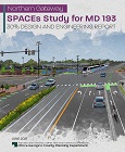
Title:
Northern Gateway SPACEs PAMC Project 30% Design and Engineering Report
Author:
The Maryland-National Capital Park and Planning Commission
Prince George's County Planning Department
Publication Date:
06/01/2021
Source of Copies:
The Maryland-National Capital Park and Planning Commission
1616 McCormick Drive
Largo, MD 20774
Number of Pages:
42
The Northern Gateway Community Development Corporation (NGCDC) seeks to balance the needs of diverse userspedestrians, bicyclists, transit users, and motoriststo shape an environment that ensures access, safety, and enjoyment of an approximately two-mile section of MD 193 (University Boulevard), now a busy, automobile-oriented environment in Langley Park. This project seeks to improve biking and pedestrian safety, better connect neighborhoods to the corridor and enhance the public realm. Significant investment in a new transit line, the Purple Line, has begun and the alignment for the portion that will serve the Northern Gateway area will run along University Boulevard, also known as the International Corridor. The International Corridor is a vibrant, diverse retail strip of African-American, South and Central American, Asian, and African businesses that provide essential goods and services to area residents. Along with new investment in transit, the new alignment provides the opportunity to link the corridor to a greater network of improved access and circulation and to integrate streetscape enhancements to a public realm that promotes a multi-modal environment and enhances a unique cultural and neighborhood identity. This report describes the goals, history, and recommendations for the Northern Gateway Strategies for Public-Space and Commercial-Corridor Enhancements (SPACEs) Planning Assistance to Municipalities and Communities (PAMC) project. This project was funded PAMC program administered by the Prince George’s County Planning Department.
North Brentwood Historic Survey
Title:
North Brentwood Historic Survey
Author:
The Maryland-National Capital Park and Planning Commission
Prince George's County Planning Department
Publication Date:
06/01/1992
Source of Copies:
The Maryland-National Capital Park and Planning Commission
14741 Governor Oden Bowie Drive
Upper Marlboro, MD 20772
Number of Pages:
71
This report summarizes the findings of an historical/architectural survey of North Brentwood, requested by the Mayor and Council of the Town. The goal of the project was to document the historic buildings and to prepare a preliminary written history of the town, the first black community to be incorporated in Prince George’s County. The report is divided into three major sections: Pre-Subdivision History, Early Sale of Lots, and Growth and Development of the Subdivision. It includes background history on the earliest development of the community, and the associations of the developer with veterans of the U. S. Colored Troops during the American Civil War. It describes the earliest dwellings built in the community, originally known as Randalltown after the family that first purchased lots and settled there in the early 1890s. It describes the expansion of the original subdivision, and the reclaiming of land formerly flooded by the Northwest Branch. It analyzes by building types the dwellings erected at the turn of the century and into the 1920s. The report also outlines the establishment of community institutions such as churches, schools, businesses, citizens’ association and firemen’s organization; it describes the community’s demographic makeup as it approached incorporation as North Brentwood in 1924. The report is supplemented by photographs, plats and maps.
Download is not available.
Document not available for download.
Native Plants of Prince George's County, Maryland 1997-1998
Title:
Native Plants of Prince George's County, Maryland 1997-1998
Author:
The Maryland-National Capital Park and Planning Commission
Publication Date:
01/01/1998
Source of Copies:
The Maryland-National Capital Park and Planning Commission
14741 Governor Oden Bowie Drive
Upper Marlboro, MD 20772
Number of Pages:
22
The Natural Resources Division of The Maryland-National Capital Park and Planning Commission encourages the planting of native species for reforestation, afforestation and landscaping projects. To facilitate this goal, we have compiled this list of native plans and their characteristics. As you use the list please feel free to contact us with comments and questions.
Related Documents:
Greenbelt Historic District Study
Title:
Greenbelt Historic District Study
Author:
The Maryland-National Capital Park and Planning Commission
Prince George's County Planning Department
Publication Date:
04/01/1994
Source of Copies:
The Maryland-National Capital Park and Planning Commission
14741 Governor Oden Bowie Drive
Upper Marlboro, MD 20772
Number of Pages:
70
This report summarizes the findings of a citizens’ study committee brought together to explore various methods of recognizing the significance of the planned community known as “Old Greenbelt.” The primary work of the study committee was an examination of the pros and cons of local historic district designation as a means of protecting community character. The study area included those portions of the present-day City of Greenbelt currently listed as an Historic District in the National Register of Historic Places. The study committee included representatives of Greenbelt Homes, Inc., private single-family property owners, members of the City of Greenbelt Advisory Planning Board, and representatives of owners of private, multifamily dwellings. Old Greenbelt is that portion of the present-day City of Greenbelt, designed and constructed as a self-sufficient “new town” between 1935 and 1941; one of three such communities built under the Green Towns Program of the Federal government’s Resettlement Administration. Greenbelt is distinguished as the most complete and, more than 50 years later, as the most intact of the Green Towns. As the first American location where the pioneering tenets of the English community planner, Sir Ebenezer Howard, were fully realized, Greenbelt has been the subject of considerable study and served as a model of community planning since before its completion. This report is divided into five primary sections: the Significance of Greenbelt, Existing Regulatory Framework, Goals and Recommendations, Historic District Implementation, and Recommended Course of Action. The report includes a background history of the design and development of the community and a description of its physical character. It includes summaries of planning and land use policies, regulations and designations currently in place. It also includes potential boundaries for a locally designated historic district and a set of design review guidelines for administering such a district. The report also outlines a recommended course of action for the pursuit of a local historic district. The report is supplemented with photographs, charts and maps.
Related Documents:
Mount Rainier Pattern Book
Title:
Mount Rainier Pattern Book
Author:
The Maryland-National Capital Park and Planning Commission
Prince George's County Planning Department
Publication Date:
06/01/2018
Source of Copies:
The Maryland-National Capital Park and Planning Commission
14741 Governor Oden Bowie Drive
Upper Marlboro, MD 20772
Number of Pages:
108
This pattern book is part of an effort to ensure additions, major renovations, new infill housing, and development respect the historic context, architectural character, and scale of Mount Rainiers established neighborhoods. The book serves as a resource for the community, homeowners, architects, contractors and builders, design review committee members, municipal reviewers, elected officials, and others interested in the history of Mount Rainier. Its purpose is to illuminate local building skills and traditions that abounded during the city’s early history and help Mount Rainier sustain the harmony and character of its buildings within their unique context.
Related Documents:
Greenbelt Historic District Draft Design Guidelines
Title:
Greenbelt Historic District Draft Design Guidelines
Author:
The Maryland-National Capital Park and Planning Commission
Prince George's County Planning Department
Publication Date:
01/01/1997
Source of Copies:
The Maryland-National Capital Park and Planning Commission
14741 Governor Oden Bowie Drive
Upper Marlboro, MD 20772
Number of Pages:
160
This document uses text and illustrations to describe the goals, concepts and guidelines of the local historic district designation process as they would affect a potential historic district focused on the planned community of Greenbelt. The document is divided into three parts. Part I of the document provides background information that addresses basic procedural questions about the purpose, function and procedures of a potential Greenbelt historic district. Part I also contains a number of recommendations regarding a potential locally designated Greenbelt Historic District including a boundary proposal and map, and a potential design review process. Part II contains an analysis of the historic and architectural significance of the planned community that is the basis for the potential district. Part III contains a set of design guidelines that could be used in the administration of an historic district.
Mount Rainier Historic District National Register Nomination
Title:
Mount Rainier Historic District National Register Nomination
Author:
The Maryland-National Capital Park and Planning Commission
Prince George's County Planning Department
Publication Date:
06/01/1989
Source of Copies:
The Maryland-National Capital Park and Planning Commission
14741 Governor Oden Bowie Drive
Upper Marlboro, MD 20772
Number of Pages:
147
This publication documents the architectural and physical character and significance of 1,152 buildings within the Mount Rainier National Register Historic District. The nomination’s two primary sections, Description and Statement of Significance, are annotated, and illustrated with photographs and maps. ‘. The Mount Rainier Historic District is significant as an early, large – and essentially intact example of the type of suburban community that changed the character of western Prince George’s County in the early years of the 20th century. The historic district is also significant for its large and diverse collection of vernacular dwellings and commercial buildings erected between c. 1900 and 1939. Most of the district’s buildings are modestly scaled, detached, single family, frame houses. Throughout the district, buildings were erected with both subtle and substantial differences. These differences represent the evolution and diversity of vernacular design throughout the early years of the 20th century. In addition, there is an important group of five revival style churches designed by local architects. At least one of the churches is the work of a firm nationally known for its ecclesiastical buildings. The district’s period of significance, 1900 to 1939, represents a time of substantial suburban growth for the western portion of Prince George’s County as part of the Washington, D.C., metropolitan area.
Download not available.
Document not available for download.
Greater Chillum Community Study
Title:
Greater Chillum Community Study
Author:
The Maryland-National Capital Park and Planning Commission
Prince George's County Planning Department
Publication Date:
12/01/2015
Source of Copies:
The Maryland-National Capital Park and Planning Commission
14741 Governor Oden Bowie Drive
Upper Marlboro, MD 20772
Number of Pages:
180
This study was initiated to investigate the needs of the Greater Chillum Community and prepare guidance to assist Prince George’s County and The Maryland-National Capital Park and Planning Commission with implementation approaches. The study area is located in an unincorporated region of Prince George’s County, east of the City of Takoma Park (Montgomery County), south of Langley Park, west of the City of Hyattsville, and north of the District of Columbia. The project concentrates on developing a comprehensive list of needs and improvement strategies with an emphasis on defining and facilitating neighborhood conservation, pedestrian safety and access, and commercial revitalization strategies and programs.
Related Documents:

Walker Mill Community I - Recreational Facilities Study
Title:
Walker Mill Community I - Recreational Facilities Study
Author:
The Maryland-National Capital Park and Planning Commission
Publication Date:
03/01/1995
Source of Copies:
The Maryland-National Capital Park and Planning Commission
14741 Governor Oden Bowie Drive
Upper Marlboro, MD 20772
Number of Pages:
76
The project is designed to assist in the provision of safe recreational opportunities for young people in the Foxglenn, Joel and Walker Mill Gardens apartments areas.
Related Documents:
Victorian Pattern Book Houses in Prince George's County
Title:
Victorian Pattern Book Houses in Prince George's County
Author:
The Maryland-National Capital Park and Planning Commission
Prince George's County Planning Department
Publication Date:
04/01/1988
Source of Copies:
The Maryland-National Capital Park and Planning Commission
14741 Governor Oden Bowie Drive
Upper Marlboro, MD 20772
Number of Pages:
84
This study will concentrate on the Victorian pattern-book house plans of R.W. Shoppell and their use in Prince George’s County, Maryland; it will serve as an introduction to the recent survey of Sears houses in the same area of the County. It is part of the on-going research projects of the Prince George’s Historic Preservation Commission, implemented by the Planning Department of the Maryland-National Capital Park and Planning Commission with a matching grant from the Certified Local Government Program of the Maryland Historical Trust.
Document not available for download.