Publications
Image Carousel


Publications Information
Transportation Review Guidelines, Part 2 2013
Title:
Transportation Review Guidelines, Part 2 2013
Author:
The Maryland-National Capital Park and Planning Commission
Prince George's County Planning Department
Publication Date:
05/01/2013
Source of Copies:
The Maryland-National Capital Park and Planning Commission
14741 Governor Oden Bowie Drive
Upper Marlboro, MD 20772
Number of Pages:
86
Draft guidelines for evaluating the adequacy of bicycle and pedestrian facilities in Centers and Corridors consistent with CB-2-2012 and the 2009 Approved Countywide Master Plan of Transportation.
Related Documents:
2004 Gateway Arts District Approved Sector Plan and Sectional Map Amendment

Title:
2004 Gateway Arts District Approved Sector Plan and Sectional Map Amendment
Author:
The Maryland-National Capital Park and Planning Commission
Prince George's County Planning Department
Publication Date:
11/01/2004
Source of Copies:
The Maryland-National Capital Park and Planning Commission
1616 McCormick Drive,
Largo, MD 20774
Number of Pages:
221
This document contains text and a map of the Approved Sector Plan and Sectional Map Amendment for the Prince George’s County Gateway Arts District. The plan amends the 1994 Approved Sector Plan and Sectional Map Amendment for Planning Area 68 and the 2002 Prince George’s County Approved General Plan. The plan contains background information, a vision statement, a land use concept, and design standards and guidelines. There are goals, objectives, and recommendations for the plan elements of land use and development patterns, environmental infrastructure, transportation systems, public facilities, economic development, urban design, historic preservation, and arts and cultural heritage. The sectional map amendment section proposes zoning changes, including use changes and an overlay zone to implement the plan’s recommendations and design standards.
Related Documents:
 01 1. Cover and Front Matter p0-vi
02 2. Background p1-10
03 4. Concept Plan p11-16
04 3. Plan Elements p17-88
05 5. Implementation p89-200
06 6. Appendices p201-221
07 CR-3-2005
08 CR-80-2007
09 Errata - Gateway Arts
10 CR-64-2012
11 Gateway Arts Plan Amendment 2014
12 R2016007
13 Admin Correction to the 2004 Approved Sector Plan for the Prince George's GAD
14 CR-78-2019
15 Admin Correction to the 2004 Approved Sector Plan for the Prince George’s GAD (2025)
01 1. Cover and Front Matter p0-vi
02 2. Background p1-10
03 4. Concept Plan p11-16
04 3. Plan Elements p17-88
05 5. Implementation p89-200
06 6. Appendices p201-221
07 CR-3-2005
08 CR-80-2007
09 Errata - Gateway Arts
10 CR-64-2012
11 Gateway Arts Plan Amendment 2014
12 R2016007
13 Admin Correction to the 2004 Approved Sector Plan for the Prince George's GAD
14 CR-78-2019
15 Admin Correction to the 2004 Approved Sector Plan for the Prince George’s GAD (2025)
Transportation Review Guidelines, Part 1 2012
Title:
Transportation Review Guidelines, Part 1 2012
Author:
The Maryland-National Capital Park and Planning Commission
Publication Date:
11/01/2012
Source of Copies:
The Maryland-National Capital Park and Planning Commission
14741 Governor Oden Bowie Drive
Upper Marlboro, MD 20772
Number of Pages:
102
The primary purpose of this document is to provide the technical standards for the evaluation of the adequacy of transportation facilities by the Prince George’s County Planning Board. Secondarily, it documents a number of processes and procedures used to review development plans as well as master, sector, and small area plans. The Guidelines establish criteria by which staff and applicants with land development proposals can assess the traffic impact and transportation issues related to development proposals. They also indicate the manner in which information will be presented to the Planning Board. Section 1 of these Guidelines describes the process of gathering existing data and submitting studies; it also include a glossary of transportation terms. Section 2 summarizes study requirements for the various types of applications. Section 3 details the methodology to be used in performing the traffic study. Sections 4 through 6 describe the use of a system of trip credits related to design as well as off-site transit, pedestrian, and bicycle facilities. Section 7 documents a number of transportation modeling procedures and their use in the analysis of plans. Section 8 includes the County Council’s Guidelines for Mitigation Actions. Section 9 specifies several processes in plan review outside of the review of traffic impact studies. Section 10 denotes the implementation and applicability of these Guidelines. A future Part 2 will be prepared no later than June 1, 2013 to guide the determination of findings related to Section 24-124.01 of the Subdivision Regulations.
Related Documents:
Town of Upper Marlboro Design Guidelines

Title:
Town of Upper Marlboro Design Guidelines
Author:
The Maryland-National Capital Park and Planning Commission
Prince George's County Planning Department
Publication Date:
12/01/2014
Source of Copies:
The Maryland-National Capital Park and Planning Commission
14741 Governor Oden Bowie Drive
Upper Marlboro, MD 20772
Number of Pages:
40
This document updates the 1981 Upper Marlboro Design Guidelines and refines ur ban design and public realm design recommendations from the 2009 Upper Marlboro Town Action Plan. The written and graphic design guidelines of this pattern book are intended to create a shared vision for the physical form of the t own core buildings and the public realm. This document is meant to be used as a reference manual in making public, private, and non-profit development decisions involving new construction, additions, alterations, renovations, restoration, signs, street furniture, and landscaping.
Related Documents:
2004 Town of Riverdale Park Mixed-Use Town Center Zone Development Plan
Title:
2004 Town of Riverdale Park Mixed-Use Town Center Zone Development Plan
Author:
The Maryland-National Capital Park and Planning Commission
Prince George's County Planning Department
Publication Date:
01/01/2004
Source of Copies:
The Maryland-National Capital Park and Planning Commission
14741 Governor Oden Bowie Drive
Upper Marlboro, MD 20772
Number of Pages:
103
The Prince George’s County Planning Board of The Maryland-National Capital Park and Planning Commission (M-NCPPC) is pleased to make available the approved Town of Riverdale Park Mixed-Use Town Center (M-U-TC) Zone Development Plan. This community-based and community-driven development plan is an important step in the effort to revitalize Riverdale Park’s town center areas along US 1 and in the older core along Queensbury Road around the MARC station. The M-U-TC Zone was originally recommended for Riverdale Park’s older commercial areas in the 1994 Planning Area 68 master plan. The M-U-TC Zone was created during the master plan process to promote the revitalization and redevelopment of the county’s older commercial centers and to allow for a mix of uses and locally established design standards and guidelines. The intent of the zone is to provide more design flexibility, while promoting more compatible development for older communities. The Riverdale Park Mixed-Use Town Center (M-U-TC) zoning map amendment process is another step in the community’s effort to revitalize its town center areas along US 1 and in the older core along Queensbury Road around the MARC station. This zone was originally recommended for Riverdale Park’s older commercial areas in the 1996 Planning Area 68 Master Plan. The M-U-TC Zone was created during the master plan process to promote the revitalization and redevelopment of the county’s older commercial centers.
Related Documents:
A-RiverdalePlan-Cover Page
B-RiverdalePlan-Table of Content
C-RiverdalePlan-Introduction
D-RiverdalePlan-Historic Overview
E-RiverdalePlan-Land Use
F-RiverdalePlan-Development and Design Concepts-compressed
G-RiverdalePlan-Design Standards
H-RiverdalePlan-Design Review Process
I-RiverdalePlan-Appendice
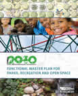
Formula 2040: Functional Master Plan for Parks, Recreation and Open Space
Title:
Formula 2040: Functional Master Plan for Parks, Recreation and Open Space
Author:
The Maryland-National Capital Park and Planning Commission
Prince George's County Planning Department
Publication Date:
01/01/2013
Source of Copies:
The Maryland-National Capital Park and Planning Commission
14741 Governor Oden Bowie Drive
Upper Marlboro, MD 20772
Number of Pages:
122
This Functional Master Plan for Parks, Recreation and Open Space, called Formula 2040 (Plan) repeals and replaces the previous functional master plan adopted in January 1982. The Plan is the culmination of work that commenced in 2008 with a Needs Assessment project called Parks & Recreation: 2010 and Beyond. The formula in Formula 2040 is Parks + Recreation = Experience. The formula is recognition that parks, recreation and leisure programming is a major component of the Department’s mission. Through the Plan, we establish a framework that will assure that we can meet future parks and recreation programmatic and facility needs.
Related Documents:
Town of Edmonston Economic Development Strategy
Title:
Town of Edmonston Economic Development Strategy
Author:
The Maryland-National Capital Park and Planning Commission
Publication Date:
05/01/2023
Source of Copies:
The Maryland-National Capital Park and Planning Commission
14741 Governor Oden Bowie Drive
Upper Marlboro, MD 20772
Number of Pages:
58
This document is an Economic Development Strategy for the Town of Edmonston, a small municipality in northern Prince George’s County, Maryland, incorporated in 1924 (Planning Area 68, Councilmanic District 5). The strategy combines demographic, economic, and real estate data in a SWOT Analysis; a community-crafted economic development vision statement, four supporting community economic development goals, and 12 action items in four priority areas for the town to implement.
Related Documents:
Forestville TNI Area Pedestrian Accessibility Study

Title:
Forestville TNI Area Pedestrian Accessibility Study
Author:
A. Morton Thomas and Associates, Inc. for The Maryland-National Capital Park and Planning Commission
Publication Date:
01/01/2020
Source of Copies:
The Maryland-National Capital Park and Planning Commission
14741 Governor Oden Bowie Drive
Upper Marlboro, MD 20772
Number of Pages:
76
The Forestville TNI Area Pedestrian Accessibility Study report provides an assessment of the pedestrian infrastructure within the Forestville TNI area and expands on the pedestrian improvement recommendations of the 2010 Approved Subregion 4 Master Plan and Sectional Map Amendment. The report reflects a collaborative effort between community stakeholders input and governmental entities that focuses on the implementation of policies and recommendations to improve pedestrian mobility/connectivity and safety throughout the study area.
Related Documents:
Town of Brentwood Primary Amendment to the Boundary of Mixed-Use Town Center Zone Development Plans & Design Guidelines
Title:
Town of Brentwood Primary Amendment to the Boundary of Mixed-Use Town Center Zone Development Plans & Design Guidelines
Author:
The Maryland-National Capital Park and Planning Commission
Prince George's County Planning Department
Publication Date:
11/01/2000
Source of Copies:
The Maryland-National Capital Park and Planning Commission
14741 Governor Oden Bowie Drive
Upper Marlboro, MD 20772
Number of Pages:
100
The Development Plan, design process and guidelines containted herein establish a framework for property owners, tenants, the local municipality, County officials and staff to review proposed new development or redevelopment within the proposed Mixed Use Town Center boundary. The Development Plan accompanies the Mixed-Use Town Center zone, which was recommended to replace the existing zones within the designated boundary as part of the master planning process. The Planning Area 68 Master Plan and Sectional Map Amendment were approved and adopted on May 1 7, 1994. The Mixed-Use Town Center Zone stipulates that regulations concerning the location, size and other provisions for all buildings and structures in the zone are as provided in an approved Town Center Development Plan. This document provides the following: a statement of intent, a brief introduction, description of the preplanning steps, description and illustrations of the short- and long-range development options, specific design principles and guidelines to guide development in the implementation of the development plan options, description of the local design review process, inventory of existing uses and street right-of-way widths, existing zoning and the M-U-TC Zone and use list.
Thriving Communities now and into the future
Title:
Thriving Communities now and into the future
Author:
The Maryland-National Capital Park and Planning Commission
Prince George's County Planning Department
Publication Date:
11/01/2014
Source of Copies:
The Maryland-National Capital Park and Planning Commission
14741 Governor Oden Bowie Drive
Upper Marlboro, MD 20772
Number of Pages:
8
Prince George’s County Planning Department 2014 Brochure
Related Documents: