Publications
Image Carousel


Publications Information
2001 Approved Anacostia Trails Heritage Area Management Plan: Public Summary

Title:
2001 Approved Anacostia Trails Heritage Area Management Plan: Public Summary
Author:
The Maryland-National Capital Park and Planning Commission
Prince George's County Planning Department
Publication Date:
09/01/2001
Source of Copies:
The Maryland-National Capital Park and Planning Commission
14741 Governor Oden Bowie Drive
Upper Marlboro, MD 20772
Number of Pages:
20
This management plan describes the heritage tourism program for the Anacostia Trails Heritage Area (ATHA) in northern Prince George’s County. ATHA is a territory of some 83.7 square miles, encompassing 14 municipalities as well as many neighborhoods in the unincorporated portions of the county. It is bounded on three sides by the county border and on the east, in part, by the Baltimore-Washington Parkway and in part by a line further east following federal land ownership to the Patuxent River, the county’s northern and eastern boundary. The federal, state and local governments own 38 percent of the land in ATHA.
Related Documents:
2022 Approved Adelphi Road-UMGC-UMD Purple Line Station Area Sector Plan and Sectional Map Amendment

Title:
2022 Approved Adelphi Road-UMGC-UMD Purple Line Station Area Sector Plan and Sectional Map Amendment
Author:
The Maryland-National Capital Park and Planning Commission
Publication Date:
06/01/2022
Source of Copies:
The Maryland-National Capital Park and Planning Commission
14741 Governor Oden Bowie Drive
Upper Marlboro, MD 20772
Number of Pages:
168
The 2022 Approved Adelphi Road-UMGC-UMD Purple Line Station Area Sector Plan is the comprehensive community plan for a new neighborhood surrounding the Adelphi Road-UMGC-UMD Purple Line Station. The Sector Plan supersedes the 1989 Approved Master Plan for Langley Park-College Park-Greenbelt and Vicinity for the portion of Planning Area 66 within this sector, and amends portions of the 2014 Plan Prince George’s 2035 Approved General Plan (Plan 2035) and other Countywide functional master plans within the sector plan area.
Anacostia Trails Heritage Area Management Plan

Title:
Anacostia Trails Heritage Area Management Plan
Author:
The Maryland-National Capital Park and Planning Commission
Prince George's County Planning Department
Publication Date:
09/01/2001
Source of Copies:
The Maryland-National Capital Park and Planning Commission
14741 Governor Oden Bowie Drive
Upper Marlboro, MD 20772
Number of Pages:
200
This document constitutes Prince George’s County’s and the City of Laurel’s management plan for heritage tourism in the Anacostia Trails Heritage Area (ATHA). ATHA is located in the northern part of Prince George’s County. The plan is an amendment to the General Plan for the Maryland-Washington Regional District Within Prince George’s County, Maryland, approved by the County Council in 1982. The management plan must also be approved by the Maryland Heritage Areas Authority in order for ATHA to be a state-certified heritage area. The plan describes ATHA and the heritage tourism resources contained therein; provides strategies for heritage tourism, interpretation, stewardship and linkages; and discusses implementation practices.
Related Documents:
 Public Summary
Cover and Abstract
Table of Contents
Chapter 1 The Anacostia Trail Heritage Area
Chapter 2 Heritage and Significance
Chapter 3 A Strategy for Heritage Tourism
Chapter 4 A Strategy for Interpretation
Chapter 5 A Strategy for Stewardship
Chapter 6 A Strategy for Linkage
Chapter 7 Implementation
Appendix A
Appendix B
Public Summary
Cover and Abstract
Table of Contents
Chapter 1 The Anacostia Trail Heritage Area
Chapter 2 Heritage and Significance
Chapter 3 A Strategy for Heritage Tourism
Chapter 4 A Strategy for Interpretation
Chapter 5 A Strategy for Stewardship
Chapter 6 A Strategy for Linkage
Chapter 7 Implementation
Appendix A
Appendix B
Adopted Sector Plan and Endorsed Sectional Map Amendment for the Addison Road Metro Town Center and Vicinity

Title:
Adopted Sector Plan and Endorsed Sectional Map Amendment for the Addison Road Metro Town Center and Vicinity
Author:
The Maryland-National Capital Park and Planning Commission
Prince George's County Planning Department
Publication Date:
01/01/2000
Source of Copies:
The Maryland-National Capital Park and Planning Commission
14741 Governor Oden Bowie Drive
Upper Marlboro, MD 20772
Number of Pages:
30
The Adopted Sector Plan and Endorsed Sectional Map Amendment consists of this Addendum to be read in conjunction with the Preliminary Sector Plan and Sectional Map Amendment for the Addison Road Metro Town Center and Vicinity. Upon approval, the plan will amend the 1985 Suit/and-District Heights and Vicinity Master Plan and the 1993 Landover and Vicinity Master Plan. The plan is also an amendment to the General Plan for the Maryland-Washington Regional District within Prince George’s County, Maryland, approved by the County Council in 1982. Developed by the community with the assistance of the Commission, this document discusses existing plans for the area, and analyzes population, employment, land use, and zoning characteristics. The sector plan proposes a town center for the area surrounding the Metro station, and sets forth concepts and recommendations for land use, access and circulation, and urban design. The document includes the approved sectional (zoning) map amendment which implements the land use recommendations of the plan for the town center. The approved Development District Standards are also included. Proposals for improvement of the surrounding community address property standards, public facilities, environmental protection, image, amenities, redevelopment initiatives, and Old Town Seat Pleasant. The document makes recommendations for implementation of the sector plan including redevelopment initiatives, a proposed sectional zoning map amendment, and design standards.
Document not available for download.
Adopted and Approved Functional Master Plan Public School Sites in Prince George's County

Title:
Adopted and Approved Functional Master Plan Public School Sites in Prince George's County
Author:
The Maryland-National Capital Park and Planning Commission
Prince George's County Planning Department
Publication Date:
10/01/1983
Source of Copies:
The Maryland-National Capital Park and Planning Commission
14741 Governor Oden Bowie Drive
Upper Marlboro, MD 20772
Number of Pages:
148
The major purpose of this planning project was to reevaluate the need for over 200 undeveloped school sites, both privately and publicly owned, that are currently shown on the County’s area and subregional master plans.
Related Documents:
Addison Road Metro Area Approved Sector Plan and Sectional Map Amendment

Title:
Addison Road Metro Area Approved Sector Plan and Sectional Map Amendment
Author:
The Maryland-National Capital Park and Planning Commission
Prince George's County Planning Department
Publication Date:
10/01/2000
Source of Copies:
The Maryland-National Capital Park and Planning Commission
14741 Governor Oden Bowie Drive
Upper Marlboro, MD 20772
Number of Pages:
292
This document contains text and maps of the Approved Sector Plan and Sectional Map Amendment for the Addison Road Metro Town Center and Vicinity. The plan amends portions of the 1985 Suit/and-District Heights and Vicinity Master Plan and the 1993 Landover and Vicinity Master Plan. The plan is also an amendment to the General Plan for the Maryland-Washington Regional District within Prince George’s County, Maryland, approved by the County Council in 1982. Developed by the community with the assistance of the Commission, this document discusses existing plans for the area, and analyzes population, employment, land use, and zoning characteristics. The sector plan proposes a town center for the area surrounding the Metro station, and sets forth concepts and recommendations for land use, access and circulation, and urban design. The document includes the approved sectional (zoning) map amendment which implements the land use recommendations of the plan for the town center. The approved Development District Standards are also included. Proposals for improvement of the surrounding community address property standards, public facilities, environmental protection, image, amenities, redevelopment initiatives, and Old Town Seat Pleasant.
Related Documents:
A Study of Occupational Shifts and Workforce Characteristics

Title:
A Study of Occupational Shifts and Workforce Characteristics
Author:
Battelle Technology Partnership Practice together with the Jacob France Institute at the University of Baltimore and Market-Economics, Inc.
Publication Date:
12/01/2011
Source of Copies:
The Maryland-National Capital Park and Planning Commission
14741 Governor Oden Bowie Drive
Upper Marlboro, MD 20772
Number of Pages:
41
The objective of this study, commissioned by the Prince George’s County Planning Department of the Maryland-National Capital Park and Planning Commission (M-NCPPC), is to provide policy/decision makers with a better understanding of occupational changes and workforce development needs and to develop a strategy to meet these needs and promote regional growth and business development. To carry out the analysis, M-NCPPC retained the services of the Battelle Technology Partnership Practice, working together with the University of Baltimore’s Jacob France Institute and Market-Economics, Inc. The analysis undertaken included both in-depth quantitative assessments of industry workforce demand and labor supply in the county, along with outreach to industry, educational institutions, and government and economic development leaders encompassing one-on-one interviews and focus groups.
A General Plan for the Maryland-Washington Regional District in Montgomery and Prince George's Counties
Title:
A General Plan for the Maryland-Washington Regional District in Montgomery and Prince George's Counties
Author:
The Maryland-National Capital Park and Planning Commission
Publication Date:
01/01/1964
Source of Copies:
The Maryland-National Capital Park and Planning Commission
14741 Governor Oden Bowie Drive
Upper Marlboro, MD 20772
Number of Pages:
154
This general plan for the physical development of the Maryland-Washington Regional District in Montgomery and Prince George’s Counties was adopted pursuant to the provisions of Chapter 780, Laws of Maryland, 1958, as amended, by resolution of January 22, 1964 after 8 duly advertised public hearings held between January 3, 1963 and February 28, 1963.
Related Documents:
Plan for Capacity Building Using 3D Modeling & Planning Decision Support Systems
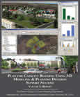
Title:
Plan for Capacity Building Using 3D Modeling & Planning Decision Support Systems
Author:
The Maryland-National Capital Park and Planning Commission
Prince George's County Planning Department
Source of Copies:
The Maryland-National Capital Park and Planning Commission
14741 Governor Oden Bowie Drive
Upper Marlboro, MD 20772
Number of Pages:
150
The Maryland-National Capital Park and Planning Commission (M-NCPPC), recognizing the value of 3D modeling and Planning Decision Support Systems (PDSS) as well as the challenges involved with implementing these tools, issued an RFP for a “Plan for Capacity Building Using 3D Modeling Applications & Planning Decision Support Systems” for the Prince George’s County Planning Department. The RFP stipulated that the Plan included an in-depth needs assessment of the Department, an evaluation of available tools, and a survey documenting the use of 3D modeling and PDSS tools by other planning departments across the nation. As a resource for other planning agencies, the first half of the report is available for download using the links below. The posted chapters summarize the findings and recommendations of the report (Chapter 1), give an overview of the methodology used (Chapter 2), document the results and findings of the national online survey and agency interviews (Chapter 3), and describe and evaluate many of the leading tools in the industry (as of early 2010, Chapter 4).
Related Documents:
Piscataway Village Rural Conservation Study Part II: Village Design Guidelines

Title:
Piscataway Village Rural Conservation Study Part II: Village Design Guidelines
Author:
The Maryland-National Capital Park and Planning Commission
Prince George's County Planning Department
Source of Copies:
The Maryland-National Capital Park and Planning Commission
14741 Governor Oden Bowie Drive
Upper Marlboro, MD 20772
Number of Pages:
88
This report is the second part of a multiyear study of the rural village of Piscataway. The first part, published in 1991, documented the history of the village, defined its unique character, and proposed design concepts and methods to protect its rural and historic qualities. The purpose of this report is to provide detailed design guidelines to assist the residents of the community in protecting the character of the village. The study was begun in late 1991, and completed in February 1995. This report, as well as the earlier study, was requested by the Historic Preservation Group of the Piscataway Citizens’ Association. The historic Village of Piscataway is located in the southwest portion of Prince George’s County, on Floral Park Road between Livingston Road and Piscataway Road. Of the remaining buildings, the earliest date from the mid-eighteenth century and the most recent from the first half of the twentieth century, all of which retain their significant architectural detail. This report is divided into four primary sections: Background, Historic Preservation in Piscataway, Village Design Guidelines and Conclusions. The report includes a summary of the historical development of Piscataway, an analysis of the village’s existing character, and an overview of existing development regulations and recent development proposals. It also includes an examination of existing preservation regulations affecting the village, as well as a building-by-building review of the village’s historic resources. Design Guidelines are provided for general maintenance, rehabilitation, additions, site improvements, new construction and streetscape improvements. The report concludes with a list of additional measures for protecting the character of Piscataway. The report is supplemented with photographs, maps and illustrations.
Related Documents: