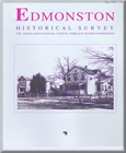
Edmonston Historical Survey

Title:
Edmonston Historical Survey
Author:
The Maryland-National Capital Park and Planning Commission
Prince George's County Planning Department
Publication Date:
07/01/1993
Source of Copies:
The Maryland-National Capital Park and Planning Commission
14741 Governor Oden Bowie Drive
Upper Marlboro, MD 20772
Number of Pages:
68
This report summarizes the findings of an historical/architectural survey of Edmonston, requested by the Mayor and Council of the Town. The goals of the project were to document the earliest of the historic buildings still standing in the Town, and to prepare a written history of the community’s development. The Town of Edmonston is located outside of the northeast boundary of the District of Columbia; it lies on the southeast side of the Baltimore and Ohio Railroad, bounded by Hyattsville on the west, Riverdale on the north and east, and Bladensburg on the south. Development of the community began around 1900 on land platted by J. Harris Rogers of Hyattsville, and shortly afterwards on adjoining land called “Palestine Farm” by Dr. Charles A. Wells. The first residents were families attracted to the area by the easily accessible transportation to and from work in Washington, D.C., offered by the Baltimore and Ohio Railroad and the City and Suburban streetcar line. The community was incorporated in 1924 as the Town of Edmonston. The report is divided into five major sections: Pre-Subdivision History, The Rogers and Wells Subdivisions, Growth and Development of East Hyattsville, Continued Development and After Incorporation. The report includes background history on the earliest development of the community, and the first subdivisions by Rogers and Wells; it also describes the settling of the first families in the newly platted subdivisions. It describes and compares the first dwellings erected in the community, and analyzes by building type a representative group of dwellings which survive from the first building period It then describes the community’s development as it approached incorporation in 1924. The report is supplemented by photographs, plats and maps.

 Edmonston Historical Survey July 1993