Publications


Broad Creek Historic District Preservation Planning Study
Title:
Broad Creek Historic District Preservation Planning Study
Author:
The Maryland-National Capital Park and Planning Commission
Prince George's County Planning Department
Publication Date:
06/01/2002
Source of Copies:
The Maryland-National Capital Park and Planning Commission
14741 Governor Oden Bowie Drive
Upper Marlboro, MD 20772
Number of Pages:
158
The Broad Creek Historic District Preservation Planning Study reflects the results of a series of design workshops conducted in 2001 by staff of the Planning and Preservation Section of the Community Planning Division, Planning Department, M-NCPPC, for property-owners, residents and others interested in the future of the Historic District. The study updates a previous planning study, provides a history and architectural survey, and clarifies county policies for protection of the historic district. The study, illustrated with photographs and maps, is divided into five major sections: Section I, the Introduction, explains a chronology of planning efforts in the community and the purpose of the present study. Section II contains a detailed history of Broad Creek from the period of Native American occupation to the end of the twentieth century. Section III contains the Architectural Character and Significance complete with photographs and individual site plans of all buildings in the district. Section IV, Planning Context, discusses environmental features, land use, zoning, transportation, parkland and trails in the district. Section V, Visioning Process and Goals for the Historic District, comprises a review of the process and results of the three design workshops. Four Appendices contain the 1987 Design Guidelines, the Historic District Advisory Committee Rules of Procedure, the Historic Area Work Permit process and other regulations, and the implementation strategies from the 1995 Broad Creek Historic District Livingston Road Streetscape Guidelines.
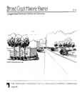
Broad Creek Historic District Livingston Road Streetscape Guidelines and Alternatives
Title:
Broad Creek Historic District Livingston Road Streetscape Guidelines and Alternatives
Author:
The Maryland-National Capital Park and Planning Commission
Prince George's County Planning Department
Publication Date:
10/01/1995
Source of Copies:
The Maryland-National Capital Park and Planning Commission
14741 Governor Oden Bowie Drive
Upper Marlboro, MD 20772
Number of Pages:
66
This report summarizes the visioning process and results of a four-month study focused on maintaining the rural character of the Broad Creek Historic District, specifically the Livingston Road corridor between Old Fort Road to the north and Fort Washington Road to the south. The project was carried out under the Planning Department’s FY 1995 Community Preservation and Design Workshops Work Program. This document was prepared as a supporting element to the original Broad Creek Historic District Design Guidelines. produced by the Historic Preservation Section and Broad Creek Historic District Advisory Committee in 1987 and approved by the District Council in 1988. Included in this report is a set of documents and plans that portray the design ideas and goals of the Broad Creek Historic District Advisory Committees and local residents.
This report is divided into five parts, each containing photographs, charts, drawings and maps produced through the visioning process and pertaining to the Livingston Road Streetscape. Each part contains information which allows the reader to follow the community visioning process from the beginning of brainstorming ideas to Ibe final design proposals and recommended courses of action. A supplemental appendix section provides plant suggestions for the Livingston Road streetscape.
Related Documents:
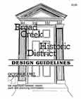
Broad Creek Historic District Design Guidelines
Title:
Broad Creek Historic District Design Guidelines
Author:
The Maryland-National Capital Park and Planning Commission
Prince George's County Planning Department
Publication Date:
10/01/1987
Source of Copies:
The Maryland-National Capital Park and Planning Commission
14741 Governor Oden Bowie Drive
Upper Marlboro, MD 20772
Number of Pages:
86
These Design Guidelines were prepared by the Board Creek Advisory Committee and staff to the Historic Perservation Commission.
Related Documents:
Broad Creek Historic District Design Guidelines
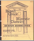
Title:
Broad Creek Historic District Design Guidelines
Author:
The Maryland-National Capital Park and Planning Commission
Prince George's County Planning Department
Publication Date:
01/01/1987
Source of Copies:
The Maryland-National Capital Park and Planning Commission
14741 Governor Oden Bowie Drive
Upper Marlboro, MD 20772
Number of Pages:
69
In July 1981, the Prince George’s County Council, in cooperation with the Maryland-National Capital Park and Planning Commission, approved the Prince George’s County Historic Sites and Districts Plan, a master plan for _he County’s preservation program. In November that year, the County Council also enacted a preservation ordinal Subtitle 29 of the County Code, which established a Historic Preservation Commission (HPC) with the power to: Evaluate historic properties for designation as Historic Sites or Historic Districts; review plans for exterior alteration, demolition, or new construction; and approve property tax credits appropriate renovation of historic structures and for compa1 new construction in historic districts. In addition, the nine-member Commission reviews any legislation, zoning map amendments or other land-use proposals affecting historic resources; assists property owners planning exterior alterations historic buildings; and maintains an ongoing survey and research program. members of the Commission are appointed by the County Executive and must be knowledgeable in such areas as architecture, planning, real estate economics, and historic preservation. The Historic Preservation Commission is also empowered to appoint members to local advisory committees “to assist and advise the Commission in the performance of its functions.”
Brentwood Historical Survey

Title:
Brentwood Historical Survey
Author:
The Maryland-National Capital Park and Planning Commission
Prince George's County Planning Department
Publication Date:
10/01/1992
Source of Copies:
The Maryland-National Capital Park and Planning Commission
14741 Governor Oden Bowie Drive
Upper Marlboro, MD 20772
Number of Pages:
66
This report summarizes the findings of an historical/ architectural survey of Brentwood, requested by the Mayor and Council of the Town. The goals of the project were to document the earliest of the historic buildings still standing in the Town, and to prepare a written history of the community’s development with emphasis on the early residents. The Town of Brentwood is located in Prince George’s County, just outside the northeast boundary of the District of Columbia. Development of the community began in the 1890s in areas platted by the Holladay and Brentwood Companies. The first residents were families attracted to the area by the easily accessible transportation to and from work in Washington, D. c., offered by the Baltimore and Ohio Railroad and the City and Suburban streetcar line. The residents of this community incorporated in 1922 as the Town of Brentwood. The report is divided into seven major sections: Pre-Subdivision History, The First Subdivision, The Second Subdivision, Growth and Development of the two Subdivisions, Continued Development, The Development of Community Institutions, and the Period of Incorporation. The report includes background history on the earliest development of the community, and on Captain Wallace A. Bartlett, the principal figure in the development of the first two subdivisions. It describes the expansion of the original subdivision, and the settling of the first families in the newly built homes. It describes and compares the first dwellings erected in the community; it analyzes by building type a representative group of dwellings which survive from the first building period. The report also outlines the establishment of community institutions such as school, church, citizens’ association and firemen’s organization, and describes the community’s development as it approached incorporation in 1922. The report is supplemented by photographs, plats and maps.
Related Documents:
Brandywine Revitalization and Preservation Study

Title:
Brandywine Revitalization and Preservation Study
Author:
The Maryland-National Capital Park and Planning Commission
Prince George's County Planning Department
Publication Date:
11/01/2011
Source of Copies:
The Maryland-National Capital Park and Planning Commission
14741 Governor Oden Bowie Drive
Upper Marlboro, MD 20772
Number of Pages:
52
This study concerns revitalization of an older community in southern Prince George’s County, located between rapidly developing areas adjacent to MD 5/US 301, and the county’s designated Rural Tier. The Brandywine Revitalization and Preservation study area straddles both the Subregion 5 and Subregion 6 master plans, approved in 2009, and responds to recommendations in those plans that a planning study focus on revitalization in this community. While this older Brandywine community has attributes of a small town and a cluster of historic resources, it lacks other characteristics that would distinguish it as such. The threat is that without a definition of the desired community character and strategies for achieving it, new development, when it arrives in old Brandywine, will subsume it into the suburban fabric of the greater community. The strategies and illustrations in this study are intended to be used as an action plan for community stakeholders to improve the look and function of the public realm, focusing on improving the Brandywine Road streetscape, pedestrian circulation and safety.
Document not available for download.
Bi-County Transitway - International Corridor Planning Study

Title:
Bi-County Transitway - International Corridor Planning Study
Author:
The Maryland-National Capital Park and Planning Commission
Prince George's County Planning Department
Publication Date:
12/01/2003
Source of Copies:
The Maryland-National Capital Park and Planning Commission
14741 Governor Oden Bowie Drive
Upper Marlboro, MD 20772
Number of Pages:
50
The Bi-County Transitway International Corridor Planning Study is a preliminary evaluation of the social, physical and economic development potential provided by the Bi-County Transitway (formerly Purple Line) in the International Corridor. The International Corridor is an area approximately one-half mile deep along University Boulevard (MD 193) from West Park Drive to the border with Montgomery County and Takoma Park. The planning study provides a demographic profile of the Corridor and summarizes a number of earlier studies and projects undertaken for this area. It provides an initial evaluation of the transit-oriented development (TOD) potential of three nodes and assesses the Corridor’s economic and physical characteristics opportunities and challenges. The study recommends the next planning actions that should be considered to advance General Plan goals for this area of Prince George’s County.
Related Documents:
Approved Westphalia Sector Plan and Sectional Map Amendment

Title:
Approved Westphalia Sector Plan and Sectional Map Amendment
Author:
The Maryland-National Capital Park and Planning Commission
Prince George's County Planning Department
Publication Date:
02/01/2007
Source of Copies:
The Maryland-National Capital Park and Planning Commission
14741 Governor Oden Bowie Drive
Upper Marlboro, MD 20772
Number of Pages:
148
This document contains text and maps of the Approved Sector Plan and Sectional Map Amendment for Westphalia. The approved plan amends portions of the 1994 Approved Master Plan and Sectional Map Amendment for Melwood-Westphalia (Planning Area 77 & 78), and the 2002 Prince George’s County Approved General Plan. Developed with the assistance of several stakeholders, this document presents background, recommends a vision, and furthers the goals, policies, and strategies pertaining to land use, zoning, environment, parks and recreation, transportation, trails, public facilities, historic preservation, and urban design. The sectional map amendment adopts zoning changes to implement the sector plan’s recommendations.
Approved Water Resources Functional Master Plan

Title:
Approved Water Resources Functional Master Plan
Author:
The Maryland-National Capital Park and Planning Commission
Prince George's County Planning Department
Publication Date:
09/01/2010
Source of Copies:
The Maryland-National Capital Park and Planning Commission
14741 Governor Oden Bowie Drive
Upper Marlboro, MD 20772
Number of Pages:
328
This report contains the text of the Approved Water Resources Functional Master Plan (Water Resources Plan). It amends Prince George’s County’s 2002 General Plan. The Water Resources Plan provides information relating to county water and sewer service capacity relative to planned growth to 2030, summarizes and provides a technical model to estimate the nutrient loadings on watersheds from existing and future conditions, and identifies the policies and strategies to amend the General Plan that are needed to maintain adequate drinking water supply and wastewater treatment capacity to 2030 and to meet water quality regulatory requirements as the county continues to grow. It satisfies the requirements of MD House Bill 1141.
Related Documents:
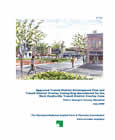
Approved Transit District Development Plan and Transit District Overlay Zoning Map Amendment for the West Hyattsville Transit District Overlay Zone
Title:
Approved Transit District Development Plan and Transit District Overlay Zoning Map Amendment for the West Hyattsville Transit District Overlay Zone
Author:
The Maryland-National Capital Park and Planning Commission
Prince George's County Planning Department
Publication Date:
07/01/2006
Source of Copies:
The Maryland-National Capital Park and Planning Commission
14741 Governor Oden Bowie Drive
Upper Marlboro, MD 20772
Number of Pages:
132
This document contains text and maps of the Approved Transit District Development Plan and Transit District Overlay Zoning Map Amendment for the West Hyattsville Transit District Overlay Zone. This plan will amend the 1998 West Hyattsville Approved Transit District Development Plan for the Transit District Overlay Zone and portions of the 1994 Planning Area 68 Master Plan. Developed by the Commission with the assistance of the community, this plan contains a comprehensive development vision, development review process requirements, and form-based development standards and guidelines. Together, these elements comprise the amended West Hyattsville Transit District Development Plan (TDDP). It controls and guides the use and development of all land within the amended Transit District Overlay Zone (TDOZ) from the initial submittal of plans to the issuance of permits. Together, the TDOZ and TDDP are intended to foster transit-oriented development that increases the use of public transit, maximizes return on investment in transit facilities and services, encourages appropriate development near transit stations with coordinated urban design elements, and increases local tax revenues.
Related Documents:
 01 Cover and Front Matter
02 Introduction - Purpose-Background-Legal Context for the Plan-Transportation Demand Management-Amendment Procedures
03 Vision - TOD in the West Hyattsville TDOZ-Vision Statement-Plan Elements
04 Transit District Development Plan
05 Building Envelope
06 Streetscape Standard
07 Architecture Standards
08 Parking Standards
09 Appendix A
10 Appendix B
01 Cover and Front Matter
02 Introduction - Purpose-Background-Legal Context for the Plan-Transportation Demand Management-Amendment Procedures
03 Vision - TOD in the West Hyattsville TDOZ-Vision Statement-Plan Elements
04 Transit District Development Plan
05 Building Envelope
06 Streetscape Standard
07 Architecture Standards
08 Parking Standards
09 Appendix A
10 Appendix B