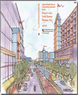
2006 Approved Henson Creek-South Potomac Master Plan and Sectional Map Amendment (Amended in 2023)

Title:
2006 Approved Henson Creek-South Potomac Master Plan and Sectional Map Amendment (Amended in 2023)
Author:
The Maryland-National Capital Park and Planning Commission
Prince George's County Planning Department
Publication Date:
04/01/2006
Source of Copies:
The Maryland-National Capital Park and Planning Commission
1616 McCormick Drive
Largo, MD 20774
Number of Pages:
166
This document contains text and maps of the approved master plan and sectional map amendment for the Henson Creek-South Potomac Planning Areas 76B and 80. This plan supercedes the 1981 Master Plan for Subregion VII and updates the 1984 Approved Subregion VII Sectional Map Amendment. It also amends the 2002 Prince George’s County Approved General Plan and other functional master plans. This plan was developed primarily during a communitywide, seven-day planning charrette. This document provides visions, goals, background, policies and strategies for numerous planning elements. The Development Pattern element generally reinforces the low-density character of the planning areas. High-intensity development is encouraged at the National Harbor Metropolitan Center and medium- to high-intensity redevelopment is encouraged at the Oxon Hill Regional Center. There is a strong emphasis on mixed-use, transit- and pedestrian-oriented development patterns in these areas. It also encourages low- to moderate-intensity mixed-use development at designated corridor nodes, activity centers, and other mixed-use areas. The plan recommends enacting conservation subdivision regulations and other flexible standards that place a premium on conserving open areas and protecting environmental features. Land use and urban design concepts and illustrations are included that encourage mixed-use, compact and pedestrian-friendly development. The Areawide Infrastructure element addresses environment, transportation, schools, fire, police, library, parks and trails. The Community Character element addresses economic development, historic preservation, urban design, and revitalization issues. The Implementation section provides short- and long-term implementation strategies and recommends specific properties and areas for future rezoning to achieve the visions and goals for those areas. The General Plan Rural and Developing Tier boundaries are redefined, the corridor along MD 210 is removed, and a new transit corridor along Oxon Hill Road is recommended.
Amended in 2023 by CR-106-2023 and CR-107-2023.
Related Documents:
 01 Front Matter and Introduction
 02 Development Pattern Element
 03 Infrastructure Elements
 04 Economic Development, Housing and Community Character Elements
 05 Implementation
 06 Appendices
 07 Land Use Map
 08 Zoning Map
 CR-106-2023 - signed
 CR-107-2023 - signed
 PGCPR 2023-93 Resolution - Adopted and Signed with Attachments
 PGCPR 2023-94 Resolution - Adopted
