Publications
Parks and Recreation Facilities Design Guidelines

Title:
Parks and Recreation Facilities Design Guidelines
Author:
The Maryland-National Capital Park and Planning Commission
Prince George's County Planning Department
Publication Date:
04/23/2025
Source of Copies:
The Maryland-National Capital Park and Planning Commission
1616 McCormick Drive
Largo, MD 20774
Number of Pages:
347
The purpose of the Design Guidelines for Parks and Recreation Facilities is to ensure that public and private recreation facilities in Prince George’s County are developed and constructed in a safe, functional, and long-lasting manner to meet residents’ recreational needs, while conserving public open space, natural resources, historic resources, and cultural resources.
The guidelines are also intended to assist in maintaining the goals of the Prince George’s County Department of Parks and Recreation:
- We want County residents to be both socially and physically connected
- We want our investments in facilities and programs to stimulate the economy
- We want our facilities and programs to have wellness components that will contribute to the physical and mental health of our patrons and the environmental health of communities.
Related Documents:
Capitol Heights Vacant Lot Strategy
Title:
Capitol Heights Vacant Lot Strategy
Author:
The Maryland-National Capital Park and Planning Commission<
Prince George's County Planning Department
Source of Copies:
The Maryland-National Capital Park and Planning Commission
1616 McCormick Drive
Largo, MD 20774
Number of Pages:
78
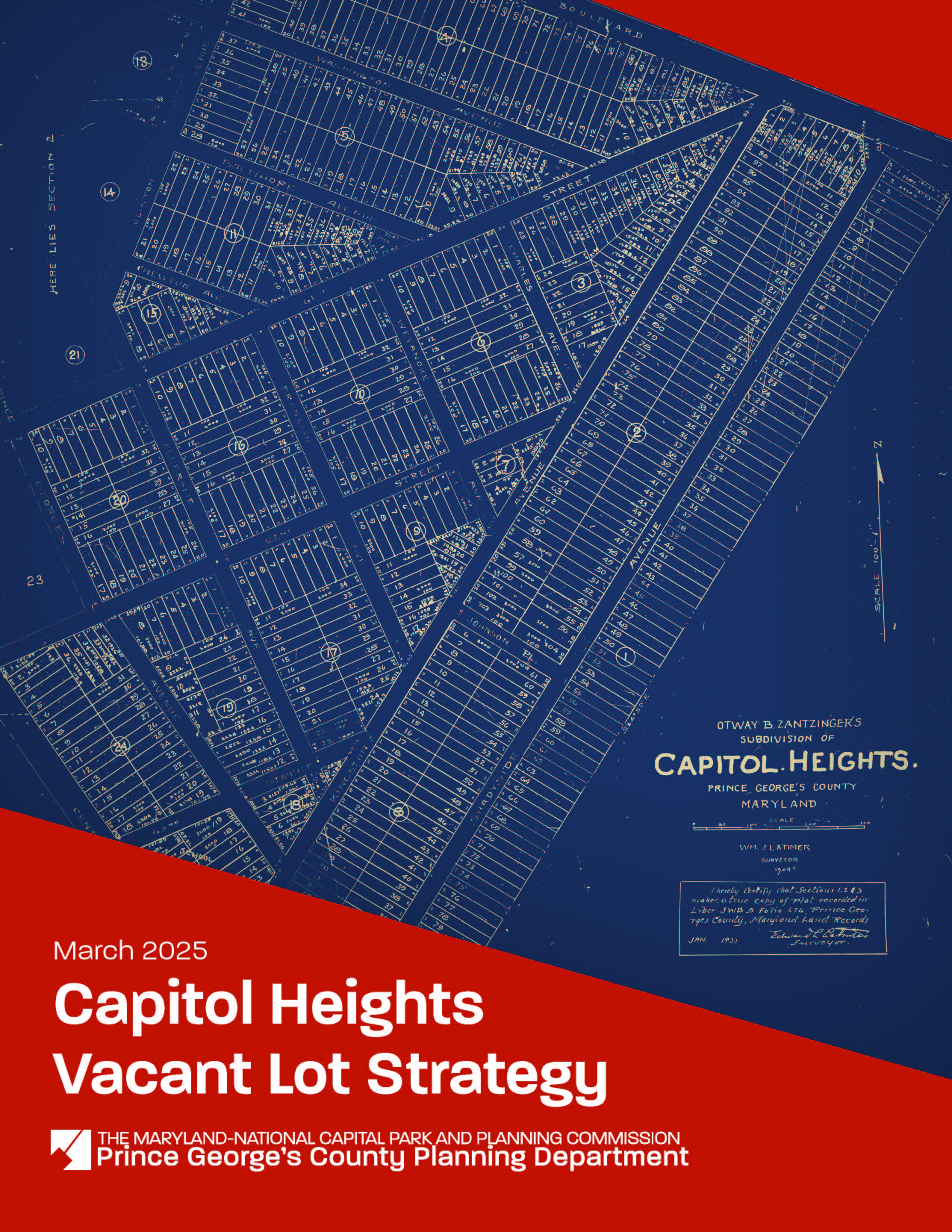
This document is a Vacant Lot Strategy for the Town of Capitol Heights, a small municipality located in Prince George’s County, Maryland, incorporated in 1910 (Planning Area 75B, Councilmanic District 7). In fall 2021, the Town applied to the Prince George’s County Planning Department’s Planning Assistance to Municipalities and Communities (PAMC) program to fund this strategy. PAMC funding was approved by the Prince George’s County Planning Board on May 26, 2022, and the project kicked off on January 13, 2023. The strategy
establishes a Vacant Lot Inventory; identifies existing regulatory, environmental, maintenance, and financial challenges; and provides goals and recommendations for maintaining, repurposing, and/or developing vacant lots. The Capitol Heights Vacant Lot Strategy aligns with
past and ongoing planning efforts by the Town, the County, and the greater Washington, DC region to support livable and transit-oriented communities.
Related Documents:
2024 New Carrollton Downtown Access and Connectivity Strategy
Title:
2024 New Carrollton Downtown Access and Connectivity Strategy
Author:
The Maryland-National Capital Park and Planning Commission<
Prince George's County Planning Department
Publication Date:
11/01/2024
Source of Copies:
The Maryland-National Capital Park and Planning Commission
1616 McCormick Drive
Upper Marlboro, MD 20774
Number of Pages:
174
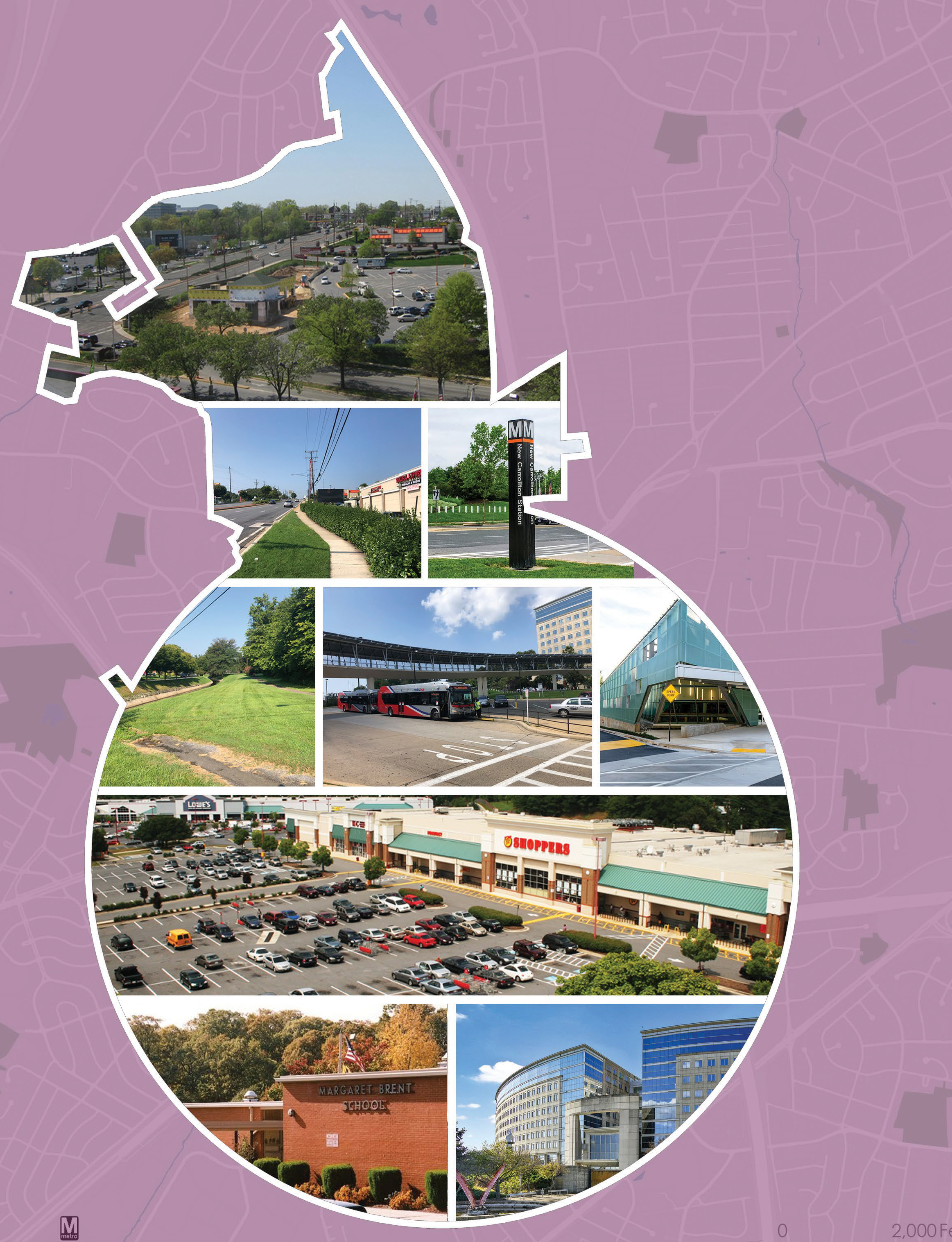
New Carrollton Metro is a Regional Transit District in Prince George’s County that is
experiencing rapid growth in transit-oriented development. Approximately 1,500 residential
units, over 1 million square feet of office space, and around 150,000 square feet of retail
are either planned, under construction, or recently built within a quarter mile of the New
Carrollton Metro Station. The station is also serviced by the Metrorail, Marc commuter train,
Amtrak, and local bus services, making it a hub for multimodal transit and a gateway to
economic centers in the region.
Despite the surge in transit-oriented development, the transit district and surrounding area
remain hard to navigate due to disconnected streets, the absence of bicycle facilities,
inhospitable pedestrian environments, and wide, auto-oriented roadways. The New Carrollton
Downtown Access and Connectivity Strategy aims to support the area’s transformation into
a walkable and connected downtown by advancing recommendations from previous studies
and offering new ideas for pedestrian and bicycle connections, crosswalk enhancements,
placemaking interventions, potential redevelopment, and street connections.
Related Documents:
Guidelines for the Analysis of the Traffic Impact of Development Proposals

Title:
Guidelines for the Analysis of the Traffic Impact of Development Proposals
Author:
The Maryland-National Capital Park and Planning Commission
Prince George's County Planning Department
Publication Date:
09/01/2002
Source of Copies:
The Maryland-National Capital Park and Planning Commission
14741 Governor Oden Bowie Drive
Upper Marlboro, MD 20772
Number of Pages:
74
This document is the technical standard for the evaluation of the adequacy of transportation facilities by the Prince George’s County Planning Board. The Guidelines establish criteria by which staff and applicants with land development proposals can assess the traffic impact of the development proposals. They also indicate the manner in which the information will be presented to the Planning Board. A glossary of terms frequently used by transportation professionals in provided in Section 1 of these Guidelines. General information for initiating a traffic study is provided in Section 2 through 4. Section 5 provides detailed guidance on study requirements for each type of application. Section 6 through 10 describe the specific procedures required for the traffic study. Section 11 describes the procedure for Transportation Facilities Mitigation Plans. Section 12 addresses the procedure for establishment of Road Clubs. The Guidelines incorporate methods and practices which are currently being used by the Prince George’s County Planning Department’s Transportation Planning Section (TPS) staff.
Related Documents:
2002 Guide to Zoning Categories

Title:
2002 Guide to Zoning Categories
Author:
The Maryland-National Capital Park and Planning Commission
Prince George's County Planning Department
Publication Date:
11/01/2010
Source of Copies:
The Maryland-National Capital Park and Planning Commission
14741 Governor Oden Bowie Drive
Upper Marlboro, MD 20772
Number of Pages:
13
This document describes the guideline for Zoning categories.
Related Documents:
Minor Public Facility Amendments (Approved)
Title:
Minor Public Facility Amendments (Approved)
Author:
The Maryland-National Capital Park and Planning Commission
Prince George's County Planning Department
Publication Date:
06/01/2002
Source of Copies:
The Maryland-National Capital Park and Planning Commission
14741 Governor Oden Bowie Drive
Upper Marlboro, MD 20772
Number of Pages:
20
This document contains text and maps in support of three proposed amendments to the 1990 Approved Largo-Lottsford Master Plan, the 1993 Approved Landover and Vicinity Master Plan, and the Master Plan of Transportation. The three proposed amendments were recommendations of the MD 202 Corridor Study, which was completed in 1997 with the cooperation of citizen groups and developer representatives. The amendments specifically under consideration would include the following: (a) the conversion of the I-95/I-495/Arena Drive interchange to full-time operation; (b) the deletion of the planned MD 202/Lottsford Road interchange in favor of an at-grade intersection; and (c) the deletion of the planned I-95/I-495/Campus Way interchange in favor of retaining an overpass, with no access to the Capital Beltway, at this location. In response to the desire of citizen groups who participated in the effort, the Planning Board and the District Council have initiated a minor public facility amendment process to further study these changes. This document only addresses the three amendments under study; it does not make any recommendations concerning the zoning of property nor does it contain any recommendations concerning nontransportation planning issues. Consideration of these three proposed amendments will be the initial step toward implementing the recommendations of the MD 202 Corridor Study.
Related Documents:
Visual Guide to Zoning Categories (December 2024)
Title:
Visual Guide to Zoning Categories (December 2024)
Author:
The Maryland-National Capital Park and Planning Commission
Prince George's County Planning Department
Publication Date:
11/01/2024
Source of Copies:
The Maryland-National Capital Park and Planning Commission
1616 McCormick Drive
Largo, MD 20774
Number of Pages:
16
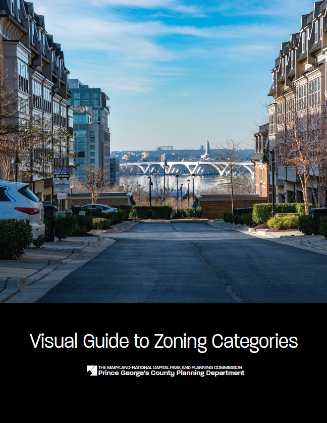
The Visual Guide to Zoning Categories represents the new Prince George’s County Zoning Ordinance zoning categories following the update to the zoning code in 2022.
Related Documents:
Town of Brentwood Primary Amendment to the Boundary of Mixed-Use Town Center Zone Development Plans & Design Guidelines
Title:
Town of Brentwood Primary Amendment to the Boundary of Mixed-Use Town Center Zone Development Plans & Design Guidelines
Author:
The Maryland-National Capital Park and Planning Commission
Prince George's County Planning Department
Publication Date:
11/01/2000
Source of Copies:
The Maryland-National Capital Park and Planning Commission
14741 Governor Oden Bowie Drive
Upper Marlboro, MD 20772
Number of Pages:
100
The Development Plan, design process and guidelines containted herein establish a framework for property owners, tenants, the local municipality, County officials and staff to review proposed new development or redevelopment within the proposed Mixed Use Town Center boundary. The Development Plan accompanies the Mixed-Use Town Center zone, which was recommended to replace the existing zones within the designated boundary as part of the master planning process. The Planning Area 68 Master Plan and Sectional Map Amendment were approved and adopted on May 1 7, 1994. The Mixed-Use Town Center Zone stipulates that regulations concerning the location, size and other provisions for all buildings and structures in the zone are as provided in an approved Town Center Development Plan. This document provides the following: a statement of intent, a brief introduction, description of the preplanning steps, description and illustrations of the short- and long-range development options, specific design principles and guidelines to guide development in the implementation of the development plan options, description of the local design review process, inventory of existing uses and street right-of-way widths, existing zoning and the M-U-TC Zone and use list.
Citizen's Handbook: Planning, Zoning, and Development Review in Prince George's County

Title:
Citizen's Handbook: Planning, Zoning, and Development Review in Prince George's County
Author:
The Maryland-National Capital Park and Planning Commission
Prince George's County Planning Department
Publication Date:
12/01/2014
Source of Copies:
The Maryland-National Capital Park and Planning Commission
14741 Governor Oden Bowie Drive
Upper Marlboro, MD 20772
Number of Pages:
66
This publication is designed as a reference handbook for citizens to describe planning, zoning, and development review activities in Prince George’s County, Maryland. Much of the information is drawn directly from the County’s Zoning Ordinance and Subdivision Regulations. The handbook consists of six chapters. The first chapter introduces the governmental entities involved with planning and zoning decisions and how to become involved in planning and development review. Chapter 2, Planning, describes the planning process. Chapter 3, Zoning, provides an overview of zoning procedures. Chapter 4, Development Review, describes subdivision, site plan, and permit review procedures, as well as other development regulations. Chapter 5 lists web resources, and Chapter 6 contains frequently asked questions.
Related Documents:
Bi-County Transitway - International Corridor Planning Study

Title:
Bi-County Transitway - International Corridor Planning Study
Author:
The Maryland-National Capital Park and Planning Commission
Prince George's County Planning Department
Publication Date:
12/01/2003
Source of Copies:
The Maryland-National Capital Park and Planning Commission
14741 Governor Oden Bowie Drive
Upper Marlboro, MD 20772
Number of Pages:
50
The Bi-County Transitway International Corridor Planning Study is a preliminary evaluation of the social, physical and economic development potential provided by the Bi-County Transitway (formerly Purple Line) in the International Corridor. The International Corridor is an area approximately one-half mile deep along University Boulevard (MD 193) from West Park Drive to the border with Montgomery County and Takoma Park. The planning study provides a demographic profile of the Corridor and summarizes a number of earlier studies and projects undertaken for this area. It provides an initial evaluation of the transit-oriented development (TOD) potential of three nodes and assesses the Corridor’s economic and physical characteristics opportunities and challenges. The study recommends the next planning actions that should be considered to advance General Plan goals for this area of Prince George’s County.


 Parks and Recreation Facilities Design Guidelines
 Capitol Heights Vacant Lot Strategy