Publications
Image Carousel


Publications Information
Prince George's County, Maryland, Cemetery Preservation Manual
Title:
Prince George's County, Maryland, Cemetery Preservation Manual
Author:
The Maryland-National Capital Park and Planning Commission
Prince George's County Planning Department
Publication Date:
12/01/2010
Source of Copies:
The Maryland-National Capital Park and Planning Commission
14741 Governor Oden Bowie Drive
Upper Marlboro, MD 20772
Number of Pages:
76
Historic cemeteries contain information on the county’s social, cultural, and historic heritage. Cemeteries provide genealogical data and information on the history of a particular place, religious practice, and lifestyle. They also display the folk art of tombstone carving and preserve the natural features of the landscape. Regrettably, many cemeteries-especially family burial plots-have been abandoned and suffer from neglect. This manual provides information on the types of cemeteries present in Prince George’s County, why it is important to preserve cemeteries, how to develop a cemetery preservation plan, where to look for funding, and how to research and survey historic cemeteries. Guidance is offered on basic preservation techniques, including initial clean-up, regular maintenance, gravestone cleaning, repairs, resetting gravestones, and selecting a skilled conservator. The appendices provide a glossary of terms commonly used in cemetery research, survey, and preservation, how to identify cemetery features, sample survey forms, cemetery laws, and a bibliography. Through this manual, M-NCPPC hopes to bolster local cemetery preservation efforts and generate additional support for the protection of historic burial grounds.
Related Documents:
 Cemetery Preservation Manual
Prince George's County Wayfinding Process Manual

Title:
Prince George's County Wayfinding Process Manual
Author:
The Maryland-National Capital Park and Planning Commission
Prince George's County Planning Department
Publication Date:
11/01/2021
Source of Copies:
The Maryland-National Capital Park and Planning Commission
14741 Governor Oden Bowie Drive
Upper Marlboro, MD 20772
Number of Pages:
62
Wayfinding has come to refer to the process of navigating from place to place and to the industry that produces the tools to help us find our way. This manual provides insight into the process of wayfinding to describe a system of tools that can be implemented to support navigation by motor vehicle, bicycle, or walking in Prince Georges County. By using this manual as a resource, communities who want to implement wayfinding will have a better understanding of how coordinated, well-executed wayfinding projects can improve movement efficiency, encourage sustainable transportation, and raise awareness of places and attractions.
Related Documents:
Prince Georges County Strategic Program for Agricultural Development

Title:
Prince Georges County Strategic Program for Agricultural Development
Author:
The Maryland-National Capital Park and Planning Commission
Prince George's County Planning Department
Source of Copies:
The Maryland-National Capital Park and Planning Commission
14741 Governor Oden Bowie Drive
Upper Marlboro, MD 20772
Number of Pages:
47
This document was first published as the Prince George’s County Agricultural Strategic Plan and is referred to as such in the Approved 2009 Subregion 6 Master Plan and Sectional Map Amendment. The statements, conclusions, and recommendations are those of the author(s) and do not necessarily reflect those of The Maryland-National Capital Park and Planning Commission.
Related Documents:
Prince Georges County Shopping Center Directory
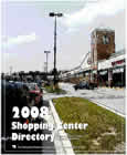
Title:
Prince Georges County Shopping Center Directory
Author:
The Maryland-National Capital Park and Planning Commission
Publication Date:
03/01/2008
Source of Copies:
The Maryland-National Capital Park and Planning Commission
1616 McCormick Drive
Largo, MD 20772
Number of Pages:
464
The 2008 Prince George’s County Shopping Center Directory contains an inventory of shopping centers in the county with descriptive information and an analysis of county retail sales. The analysis examines past and recent trends, vacancy characteristics, new shopping center construction, and various shopping center types in the county. The directory includes basic data such as shopping center name, location, owner/developer, year opened, gross leasable area, leasing contacts, and tenant information.
Related Documents:
Prince George's County Scenic Byway Plan Elements: A Corridor Management Program for Croom and Aquasco Roads and Related Star-Spangled Banner Historic Roadways

Title:
Prince George's County Scenic Byway Plan Elements: A Corridor Management Program for Croom and Aquasco Roads and Related Star-Spangled Banner Historic Roadways
Author:
The Maryland-National Capital Park and Planning Commission
Prince George's County Planning Department
Publication Date:
05/01/2012
Source of Copies:
The Maryland-National Capital Park and Planning Commission
14741 Governor Oden Bowie Drive
Upper Marlboro, MD 20772
Number of Pages:
54
This document presents concepts for promoting more context-sensitive design along the Star-Spangled Banner Scenic Byway (SSBSB) Corridor in southeastern Prince George’s County as both public improvements to roadways and private development along these roadways occur. Many of the concepts, particularly related to solutions for enhancing transportation safety while maintaining rural character, were presented and refined through a series of interactive public meetings held in southeastern Prince George’s County between November 2010 and the present. A visual preference survey was administered in March 2011 to a group of more than 70 residents and stakeholders to gauge interest in various building styles and site layouts for new development outside of the scenic byway’s right-of-way. A buildout analysis of the remaining existing residential dwelling units under current regulations and site conditions was completed, and several village development explorations were generated from the visual survey results. These scenarios are presented in a separate document, The Rural Villages Study.
Related Documents:
Prince George's County Retail Marketability and Competitiveness Study

Title:
Prince George's County Retail Marketability and Competitiveness Study
Author:
The Maryland-National Capital Park and Planning Commission
Prince George's County Planning Department
Publication Date:
05/01/2016
Source of Copies:
The Maryland-National Capital Park and Planning Commission
14741 Governor Oden Bowie Drive
Upper Marlboro, MD 20772
Number of Pages:
46
Prince George’s County Retail Marketability and Competitiveness Study
The purpose of this marketability analysis is to evaluate Prince George’s County’s retail markets and their opportunities utilizing RCLCO’s knowledge of retail success factors in order to identify areas of the County that are growing, areas that are stable, and areas that may need intervention. The marketability analysis begins with an explanation of the site selection criteria retailers consider when deciding where to locate, analyzes which areas of Prince George’s County meet those criteria, and explains RCLCO’s understanding of the alignment between existing centers and demographics at the submarket level.
Related Documents:
Prince George's County Retail Market Analysis

Title:
Prince George's County Retail Market Analysis
Author:
Prepared by RCLCO for The Maryland-National Capital Park and Planning Commission
Publication Date:
08/01/2015
Source of Copies:
The Maryland-National Capital Park and Planning Commission
14741 Governor Oden Bowie Drive
Upper Marlboro, MD 20772
Number of Pages:
71
The challenge for retail in Prince Georges County pertains to quality more so than quantity. On the surface, the County is not significantly over-retailed relative to the national or regional average retail square feet (SF) per person, but the average productivity (sales per square foot) of that retail space is less than in other comparable counties in the Washington-Baltimore region. New retail centers built since 2006 have demonstrated strong market absorption, but are often cannibalizing the tenants of older shopping centers which show negative net absorption during the same time period. This creates an environment where lower quality tenants can over achieve and locate in better space than they typically would occupy. Local-serving retail centers in Prince Georges County display this phenomenon most often: many community centers contain tenants that would be more appropriately located in neighborhood centers, and neighborhood centers contain tenants that would be more appropriate for unanchored convenience/in-line retail.
Prince George's County Population, Housing, and Economic Survey
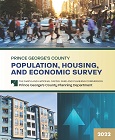
Title:
Prince George's County Population, Housing, and Economic Survey
Author:
The Maryland-National Capital Park and Planning Commission
Prince George's County Planning Department
Publication Date:
10/01/2022
Source of Copies:
The Maryland-National Capital Park and Planning Commission
14741 Governor Oden Bowie Drive
Upper Marlboro, MD 20772
Number of Pages:
82
The Population, Housing, and Economic Survey is compiled and written by the Prince George’s County Planning Department and covers recent data on population, housing, social, and economic data for Prince George’s County, Maryland. It includes additional historical and comparative data with other localities of the metropolitan Washington area. The report offers raw data with accompanying tables, graphs, or charts to show changes or trends in the data and how they are reflected in the County, all drawn from reliable and authoritative data sources. The overall purpose of the survey is to provide a convenient, organized summary and reference document for the general public, M-NCPPC, and local governments and to provide information to assist in planning and policymaking that would affect Prince George’s County. The Prince George’s County Planning Department expects to produce regular updates of the survey.
Related Documents:
Prince George's County Master Plan of Transportation 2035 (MPOT 2035) Current Conditions Report
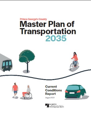
Title:
Prince George's County Master Plan of Transportation 2035 (MPOT 2035) Current Conditions Report
Author:
The Maryland-National Capital Park and Planning Commission
Prince George's County Planning Department
Publication Date:
08/01/2022
Source of Copies:
The Maryland-National Capital Park and Planning Commission
1616 McCormick Drive
Largo, MD 20774
Number of Pages:
84
Master Plan of Transportation 2035 (MPOT 2035) supports Plan Prince George’s 2035, the County’s approved general plan, by setting a guiding vision, supporting goals, and measurable actions to achieve a more equitable transportation system for all people who travel in the County, regardless of which travel mode they choose. MPOT 2035 will update and replace the 2009 MPOT and the transportation recommendations from active area and sector master plans. View/download a full version of MPOT 2035.
Approved General Plan

Title:
Approved General Plan
Author:
The Maryland-National Capital Park and Planning Commission
Prince George's County Planning Department
Publication Date:
10/01/2002
Source of Copies:
The Maryland-National Capital Park and Planning Commission
14741 Governor Oden Bowie Drive
Upper Marlboro, MD 20772
The General Plan makes comprehensive recommendations for guiding future development within Prince George’s County, Maryland. The plan designates more than two dozen Centers, which are focal points for increased efforts to concentrate development that can take advantage of existing or future investments in high capacity mass transit services. The plan also designates seven Corridors where more intensive development should be encouraged. It proposes three development tiers within the county (the Developed, Developing and Rural Tiers) and proposes policies to guide development within each tier. The plan recommends goals, objectives, policies, and strategies for the following plan elements: Environmental Infrastructure, Transportation Systems, Public Facilities, Economic Development, Housing, Revitalization, Urban Design, and Historic Preservation. Plan implementation through future intergovernmental coordination, public participation, planning, regulatory measures, and plan monitoring is described.