Publications
Summary and Analysis of Residential Development PA & PAZ January 1975 - June 1978
Title:
Summary and Analysis of Residential Development PA & PAZ January 1975 - June 1978
Author:
The Maryland-National Capital Park and Planning Commission
Prince George's County Planning Department
Publication Date:
02/01/1979
Source of Copies:
The Maryland-National Capital Park and Planning Commission
14741 Governor Oden Bowie Drive
Upper Marlboro, MD 20772
Number of Pages:
59
This report coordinates, simplifies and analyzes the data coming from complex subdivision process in Prince Georges County, Maryland. This automated approach to compiling subdivision data is designed to assist the public and private sectors of land use planners, developers, market researchers, and policy decision makers in making more accurate and timely forecasts of future development.
Document not available for download.
Suitland Metro Station and Silver Hill TNI Pedestrian Accessibility Study

Title:
Suitland Metro Station and Silver Hill TNI Pedestrian Accessibility Study
Author:
A. Morton Thomas and Associates, Inc. for The Maryland-National Capital Park an d Planning Commission
Publication Date:
01/01/2020
Source of Copies:
The Maryland-National Capital Park and Planning Commission
14741 Governor Oden Bowie Drive
Upper Marlboro, MD 20772
Number of Pages:
68
The Suitland Metro Station and Silver Hill TNI Pedestrian Accessibility Study report provides an assessment of the pedestrian infrastructure within the Suitland Metro Station and Silver Hill TNI area and expands on the pedestrian improvement recommendations of the 2014 Approved Southern Green Line Area Sector Plan and Sectional Map Amendment. The report reflects a collaborative effort between community stakeholders input and governmental entities that focuses on the implementation of complete streets policies where possible and recommendations to improve pedestrian mobility/connectivity and safety throughout the study area.
Related Documents:
Subdivision Cross Reference Listings January 1975 - June 1978
Title:
Subdivision Cross Reference Listings January 1975 - June 1978
Author:
The Maryland-National Capital Park and Planning Commission
Prince George's County Planning Department
Publication Date:
01/01/1977
Source of Copies:
The Maryland-National Capital Park and Planning Commission
14741 Governor Oden Bowie Drive
Upper Marlboro, MD 20772
Number of Pages:
132
The following reports are formatted for only one geographic unit the planning area. The report of time spans the year January 1, 1975 to July 1, 1978. Each report covers one calendar year and gives information on Preliminary Plans of Subdivision submitted, Preliminary Plans of Subdivision approved by the Prince Georges County Planning Board, and Plats of Subdivision recorded in the Office of Lan Records of Prince Georges County.
Document not available for download.
Subdivision Activity 1977
Title:
Subdivision Activity 1977
Author:
The Maryland-National Capital Park and Planning Commission
Prince George's County Planning Department
Publication Date:
01/01/1977
Source of Copies:
The Maryland-National Capital Park and Planning Commission
14741 Governor Oden Bowie Drive
Upper Marlboro, MD 20772
Number of Pages:
142
The following reports are formatted for only one geographic unit the planning area. The report of time spans the year January 1, 1975 to July 1, 1978. Each report covers one calendar year and gives information on Preliminary Plans of Subdivision submitted, Preliminary Plans of Subdivision approved by the Prince Georges County Planning Board, and Plats of Subdivision recorded in the Office of Lan Records of Prince Georges County.
Document not available for download.
Subdivision Activity 1976
Title:
Subdivision Activity 1976
Author:
The Maryland-National Capital Park and Planning Commission
Prince George's County Planning Department
Publication Date:
01/01/1976
Source of Copies:
The Maryland-National Capital Park and Planning Commission
14741 Governor Oden Bowie Drive
Upper Marlboro, MD 20772
Number of Pages:
136
The following reports are formatted for only one geographic unit the planning area. The report of time spans the year January 1, 1975 to July 1, 1978. Each report covers one calendar year and gives information on Preliminary Plans of Subdivision submitted, Preliminary Plans of Subdivision approved by the Prince Georges County Planning Board, and Plats of Subdivision recorded in the Office of Lan Records of Prince Georges County.
Document not available for download.
Subdivision Activity 1975
Title:
Subdivision Activity 1975
Author:
The Maryland-National Capital Park and Planning Commission
Prince George's County Planning Department
Publication Date:
01/01/1975
Source of Copies:
The Maryland-National Capital Park and Planning Commission
14741 Governor Oden Bowie Drive
Upper Marlboro, MD 20772
Number of Pages:
192
The following reports are formatted for only one geographic unit the planning area. The report of time spans the year January 1, 1975 to July 1, 1978. Each report covers one calendar year and gives information on Preliminary Plans of Subdivision submitted, Preliminary Plans of Subdivision approved by the Prince Georges County Planning Board, and Plats of Subdivision recorded in the Office of Lan Records of Prince Georges County.
Document not available for download.
Strategic Framework for Transit-Oriented Development in Prince George's County

Title:
Strategic Framework for Transit-Oriented Development in Prince George's County
Author:
The Maryland-National Capital Park and Planning Commission
Prince George's County Planning Department
Publication Date:
05/01/2003
Source of Copies:
The Maryland-National Capital Park and Planning Commission
14741 Governor Oden Bowie Drive
Upper Marlboro, MD 20772
Number of Pages:
142
The Strategic Framework for Transit-Oriented Development (TOD) in Prince George’s County is a countywide planning document for attracting TOD to Prince George’s County as a means of achieving General Plan development goals and objectives. The framework discusses the history and employment of TOD, including other jurisdictions’ best practices and lessons learned elsewhere in the metropolitan region and the United States. It discusses opportunities, challenges and policymaking issues associated with employing TOD planning in Prince George’s County. The framework provides criteria for evaluating the TOD potential of 15 Metrorail and 2 stand-alone MARC (commuter rail) stations in the county, and includes descriptions of those station areas. It provides a case study of TOD planning for the West Hyattsville Metrorail station area and makes planning, community outreach, procedural and interagency and intergovernmental coordination recommendations for attracting TOD to the county.
Staff Draft West Hyattsville-Queens Chapel Sector Plan

Title:
Staff Draft West Hyattsville-Queens Chapel Sector Plan
Author:
The Maryland-National Capital Park and Planning Commission
Prince George's County Planning Department
Publication Date:
07/01/2022
Source of Copies:
The Maryland-National Capital Park and Planning Commission
14741 Governor Oden Bowie Drive
Upper Marlboro, MD 20772
Number of Pages:
282
The 2022 Staff Draft West Hyattsville-Queens Chapel Sector Plan is the proposed sector plan for the southwestern portion of Planning Area 68. Upon approval, the West Hyattsville-Queens Chapel Sector Plan will supersede the 2006 Approved Transit District Development Plan for the West Hyattsville Transit District Overlay Zone in its entirety, and the 1994 Approved Master Plan for Planning Area 68 and 2004 Approved Sector Plan for the Prince George’s County Gateway Arts District for the portion of Planning Area 68 within this Sector. This plan will amend portions of the 2014 Plan Prince George’s 2035 Approved General Plan (Plan 2035) and other Countywide functional master plans within the West Hyattsville-Queens Chapel sector.
Related Documents:
Fairmount Heights Residential Facade and Property Improvement Guidelines
Title:
Fairmount Heights Residential Facade and Property Improvement Guidelines
Author:
The Maryland-National Capital Park and Planning Commission
Prince George's County Planning Department
Publication Date:
08/01/1993
Source of Copies:
The Maryland-National Capital Park and Planning Commission
14741 Governor Oden Bowie Drive
Upper Marlboro, MD 20772
Number of Pages:
86
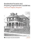
This project is part of FY 1991 M-NCPPC Planning Assistance to Municipalities and Communities Program requested by the Town of Fairmount Heights. It provides guidelines for use by homeowners and builders who plan to make exterior repairs or new home construction that are visible from the public right-of-way. The text establishes the importance of guidelines in preserving the historic character of the Town. It also includes a brief history of Fairmount Heights, the importance of the total streetscape and its relationship with infill construction, facade details including appropriate and in-appropriate examples, case studies of rehabilitation preserving/destroying original character, landscaping examples and appropriate plant materials, and possible funding sources.
Related Documents:
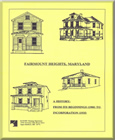
Fairmount Heights - A History: From Its Beginnings (1900) to Incorporation (1935)
Title:
Fairmount Heights - A History: From Its Beginnings (1900) to Incorporation (1935)
Author:
The Maryland-National Capital Park and Planning Commission
Prince George's County Planning Department
Publication Date:
07/01/1991
Source of Copies:
The Maryland-National Capital Park and Planning Commission
14741 Governor Oden Bowie Drive
Upper Marlboro, MD 20772
Number of Pages:
45
This report summarizes the findings of an architectural/historical survey of Fairmount Heights, requested by the Mayor and Council of the Town. The goal of the project was to prepare a history of the development of the community from its earliest subdivision in 1900. The report describes the sequential platting, between 1900 and 1923, of the six subdivisions which make up the present-day municipality; it describes the building of some of the earliest homes, and the establishment of community institutions such as schools, churches, the social hall and citizens associations. It analyzes and compares the architectural forms of the residential buildings, and describes the community in 1935 as it achieved incorporation, at that time the largest black municipality in Prince George’s County. The report is supplemented by photographs, plats and maps.





 Silver Hill TNI Area Reportv5