Publications


2010 Approved Master Plan and Sectional Map Amendment for Subregion 1 (Planning Areas 60, 61, 62, and 64)

Title:
2010 Approved Master Plan and Sectional Map Amendment for Subregion 1 (Planning Areas 60, 61, 62, and 64)
Author:
The Maryland-National Capital Park and Planning Commission
Prince George's County Planning Department
Publication Date:
06/01/2010
Source of Copies:
The Maryland-National Capital Park and Planning Commission
14741 Governor Oden Bowie Drive
Upper Marlboro, MD 20772
Number of Pages:
194
This document is the Approved Master Plan and Sectional Map Amendment (SMA) for Subregion I (Planning Areas 60, 61, 62, and 64). It supersedes the 1990 Approved Master Plan and Sectional Map Amendment for Subregion I (Planning Areas 60, 61, and 62). Developed with the assistance of the community, this document recommends goals, strategies, and action pertaining to land use, zoning, environment, parks and recreation, transportation, trails, public facilities, historic preservation, urban design, economic development and community character, and living areas. The SMA establishes zoning changes to implement the master plan’s recommendations.
Related Documents:
 Subregion 1
2013 Approved Greenbelt Metro Area and MD 193 Corridor Sector Plan and Sectional Map Amendment

Title:
2013 Approved Greenbelt Metro Area and MD 193 Corridor Sector Plan and Sectional Map Amendment
Author:
The Maryland-National Capital Park and Planning Commission
Publication Date:
03/01/2013
Source of Copies:
The Maryland-National Capital Park and Planning Commission
Number of Pages:
444
This sector plan updates the 2001 Approved Sector Plan and Sectional Map Amendment for the Greenbelt Metro Area and amends portions of the 1989 Approved Master Plan for Langley Park-College Park-Greenbelt and Vicinity and 1990 Adopted Sectional Map Amendment for Planning Areas 65, 66, and 67. Developed with the active participation of the community, including property owners, developers, residents, and elected officials; this document recommends goals, policies, strategies, and actions pertaining to land use, urban design, the environmental and green infrastructure networks, the multimodal transportation system, housing, economic development, health and wellness, the Greenbelt medical mile, public facilities, parks and recreation, historic preservation, zoning, and implementation. The plan builds upon the recommendations of the 2002 Approved General Plan for Prince George’s County for centers and corridors in the Developed Tier, addresses sustainable development tied to existing and proposed mass transit options, and incorporates recommendations from functional area master plans such as the Green Infrastructure Functional Master Plan, Master Plan of Transportation, and Water Resources Functional Master Plan. The Sectional Map Amendment proposes zoning changes to implement the land use recommendations of the sector plan.
2018 Approved Greater Cheverly Sector Plan

Title:
2018 Approved Greater Cheverly Sector Plan
Author:
The Maryland-National Capital Park and Planning Commission
Prince George's County Planning Department
Publication Date:
01/01/2018
Source of Copies:
The Maryland-National Capital Park and Planning Commission
14741 Governor Oden Bowie Drive
Upper Marlboro, MD 20772
Number of Pages:
172
The Greater Cheverly Sector Plan amends the 2014 Prince George’s County 2035 Approved General Plan (Plan 2035) by defining the boundary of the Cheverly Metro Local Transit Center. The sector plan replaces the 2005 Approved Sector Plan for the Tuxedo Road/Arbor Street/Cheverly Metro Area in its entirety and the 1994 Approved Bladensburg, New Carrolton, and Vicinity Master Plan, the 2009 Approved Port Towns Sector Plan, the 2010 Approved Subregion 4 Master Plan, and the 2014 Landover Metro Area and MD 202 Corridor Approved Sector Plan for the portions of Planning Areas 69 and 72 within the sector plan boundaries. In addition, this sector plan amends the 2009 Approved Countywide Master Plan of Transportation and Formula 2040: Functional Master Plan for Parks, Recreation and Open Space (2015). The sector plan was developed with assistance from civic associations, municipalities, business and property owners, government officials and agencies, and an extensive planning effort engaged property owners, citizens, residents, civic associations, and other stakeholders in public participation activities, which resulted in valuable contributions to the sector plan. The sector plan represents an effort to chart a direction for future planning policy in the sector plan area. This document includes goals, policies and strategies for planning elements in order to improve conditions in the sector plan area in the coming years.
Related Documents:
2014 Approved Eastover-Forest Heights-Glassmanor Sector Plan and Sectional Map Amendment (SMA)

Title:
2014 Approved Eastover-Forest Heights-Glassmanor Sector Plan and Sectional Map Amendment (SMA)
Author:
The Maryland-National Capital Park and Planning Commission
Prince George's County Planning Department
Publication Date:
02/01/2014
Source of Copies:
The Maryland-National Capital Park and Planning Commission
14741 Governor Oden Bowie Drive
Upper Marlboro, MD 20772
Number of Pages:
178
This Sector Plan and SMA updates and amends portions of The Approved Master Plan and Sectional Map Amendment for the Heights and Vicinity (Planning Area 76A) (November 2000). The sector plan and SMA builds upon and implements the 2002 Prince George’s County Approved General Plan, and all other approved functional master plans. Developed with the active participation of the community; including property owners, developers, residents, and elected officials, this document recommends goals, policies, strategies, and actions pertaining to land use, urban design, environmental infrastructure, transportation systems, housing, economic development, health and wellness, public facilities, parks and recreation, zoning, and implementation. This plan builds upon recommendations in the 2002 Prince George’s County Approved General Plan for centers and corridors in the Developed Tier and promotes sustainable development. The SMA proposes zoning changes to implement the land use recommendations of the sector plan. The sector plan contains policies, objectives, and recommendations to guide future growth and development along the MD 210/Indian Head Highway corridor and within the sector plan area. The SMA serves as a mechanism to help implement the sector plan recommendations and policies by amending the zoning map.
Related Documents:
2017 Approved East Riverdale-Beacon Heights Sector Plan
Title:
2017 Approved East Riverdale-Beacon Heights Sector Plan
Author:
The Maryland-National Capital Park and Planning Commission
Prince George's County Planning Department
Publication Date:
04/01/2017
Source of Copies:
The Maryland-National Capital Park and Planning Commission
14741 Governor Oden Bowie Drive
Upper Marlboro, MD 20772
Number of Pages:
239
The East Riverdale-Beacon Heights Sector Plan amends the 2014 Plan Prince George’s 2035 Approved General Plan by defining the Beacon Heights and Riverdale Park Neighborhood Centers. This Sector Plan will replace the 1994 Approved Master Plan for Planning Area 68 and the 1994 Approved Master Plan for Bladensburg-New Carrollton and Vicinity (Planning Area 69) for the portions of Planning Areas 68 and 69 within the Sector Plan boundaries. In addition, this Sector Plan will amend the 2001 Approved Anacostia Trails Heritage Area Management Plan: A Functional Master Plan for Heritage Tourism, the 2008 Approved Public Safety Facilities Master Plan, 2009 Approved Countywide Master Plan of Transportation, the 2014 Formula 2040: Functional Master Plan for Parks, Recreation and Open Space, and the 2017 Approved Resource Conservation Plan. This plan carries forward key recommendations from the 2008 Central Kenilworth Avenue Revitalization Study and the 2013 Purple Line Transit-Oriented Development Study.
2015 Approved College Park-Riverdale Park Transit District Development Plan & TDOZMA
Title:
2015 Approved College Park-Riverdale Park Transit District Development Plan & TDOZMA
Author:
The Maryland-National Capital Park and Planning Commission
Publication Date:
03/01/2015
Source of Copies:
The Maryland-National Capital Park and Planning Commission
Number of Pages:
340
This transit district development plan updates the 1997 Approved Transit District Development Plan for the College Park-Riverdale Transit District Overlay Zone and amends portions of the 1989 Approved Master Plan for Langley Park-College Park-Greenbelt and Vicinity, and Adopted Sectional Map Amendment for Planning Areas 65, 66, and 67, and the 1994 Approved Master Plan and Sectional Map Amendment for Planning Area 68. Developed with the active participation of the community, property owners, developers, residents, and elected officials, this document establishes a vision for the future of the College Park-Riverdale Park transit district and recommends goals, policies, strategies, and actions pertaining to land use, urban design, the multimodal transportation system, environmental and green infrastructure networks, health and wellness, parks and recreation, economic development, housing and neighborhoods, community heritage and culture, public facilities, zoning, and implementation. The plan builds upon the recommendations of the 2014 Adopted Plan Prince Georges 2035 for major regional centers and the innovation corridor, addresses sustainable mixed-use development tied to existing and proposed mass transit options, and incorporates recommendations from functional area master plans such as the Approved Countywide Master Plan of Transportation, the Approved Countywide Green Infrastructure Plan, and the Approved Water Resources Functional Master Plan.
Related Documents:
2013 Approved Central Branch Avenue Corridor Revitalization Sector Plan
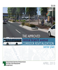
Title:
2013 Approved Central Branch Avenue Corridor Revitalization Sector Plan
Author:
The Maryland-National Capital Park and Planning Commission
Prince George's County Planning Department
Publication Date:
04/01/2013
Source of Copies:
The Maryland-National Capital Park and Planning Commission
14741 Governor Oden Bowie Drive
Upper Marlboro, MD 20772
Number of Pages:
158
The sector plan amends portions of the 2000 Approved Master Plan and Sectional Map Amendment for the Heights and Vicinity (Planning Area 76A), 2006 Approved Master Plan and Sectional Map Amendment for the Henson Creek-South Potomac Planning Area, 2008 Approved Branch Avenue Corridor Sector Plan and Sectional Map Amendment, and 1993 Approved Subregion 5 Master Plan and Sectional Map Amendment. This sector plan builds on the opportunities for growth and revitalization within communities along the Central Branch Avenue Corridor created by the potential future growth at Joint Base Andrews, the planned expansion of Southern Maryland Hospital, and the planned fixed guideway transit line along MD 5. These events, coupled with plans for transit-oriented development at the Branch Avenue Metro Station, create opportunities to reposition key commercial and employment centers and offer a broader range of housing options. The sector plan highlights these and other key opportunities and constraints. It presents redevelopment programs to guide future growth and revitalization at future transit nodes and within suburban strip shopping centers in six focus areas along Branch Avenue and the Allentown, Suitland, and St. Barnabas Road commercial corridors. Developed with extensive public participation, this document presents background information; plan goals; focus area visions and recommendations pertaining to land use, future zoning, development programs, and concepts; corridorwide recommendations for land use, community design, the environment, transportation, recreation and parks, schools, and historic preservation; and implementation strategies.
Related Documents:
Technical Summary for the Preliminary General Plan: Infrastructure, Transportation, Public Facilities
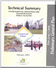
Title:
Technical Summary for the Preliminary General Plan: Infrastructure, Transportation, Public Facilities
Author:
The Maryland-National Capital Park and Planning Commission
Prince George's County Planning Department
Publication Date:
02/01/2002
Source of Copies:
The Maryland-National Capital Park and Planning Commission
14741 Governor Oden Bowie Drive
Upper Marlboro, MD 20772
Number of Pages:
86
The Technical Summary for the Preliminary General Plan: Infrastructure, Transportation, Public Facilities provides background information in support of the 2002 Preliminary General Plan for Prince George’s County. This information, based on staff and consultant analyses, helped guide the Prince George’s County Planning Department in making recommendations contained in the Preliminary General Plan and will also be used in the preparation of future plans. The report is divided into three parts. The Environment Infrastructure section describes background information and analyses for green infrastructure, woodland conservation, water quality, energy efficiency, green building, and outdoor lighting. The Transportation section describes the transportation model used to analyzed the mid-range (2005) impacts of the Preferred Development Alternative upon which the Preliminary Plan’s recommendations are based. The general implications of the model results are also discussed. The Public Facilities section describes background analyzed for schools, fire and rescue, police, and library facilities. These analyses were used to make Preliminary General Plan recommendations for fire and rescue facilities, as well as establishing objectives for libraries and police facilities. The school facilities analysis included in this document projects mid-range (2005) school (elementary, middle, and high) seats needed within large sections of the county.
Document not available for download.
Technical Report: A Study of Occupational Shifts and Workforce Characteristics for Prince George's County
Title:
Technical Report: A Study of Occupational Shifts and Workforce Characteristics for Prince George's County
Author:
Battelle Technology Partnership Practice together with the Jacob France Institute at the University of Baltimore and Market-Economics, Inc.
Publication Date:
12/01/2011
Source of Copies:
The Maryland-National Capital Park and Planning Commission
14741 Governor Oden Bowie Drive
Upper Marlboro, MD 20772
Number of Pages:
87
This report serves as the Technical Report to the Study of Occupational Shifts and Workforce Characteristics in Prince George’s County prepared for the Prince George’s County Planning Department of the Maryland-National Capital Park and Planning Commission (M-NCPPC). This Technical Report provides a more detailed analysis of the quantitative and qualitative findings that are the underpinnings of the results of the study. The objective of the study is to provide policy/decision makers with a better understanding of occupational changes and workforce development needs, and to develop a strategy to meet these needs and promote regional growth and business development. This calls for a comprehensive assessment of the expected future workforce demands from likely industry drivers and a rigorous analysis of the county’s capacity to meet these future needs.
Technical Data Base Study Western Branch Watershed, Prince George's County, Maryland

Title:
Technical Data Base Study Western Branch Watershed, Prince George's County, Maryland
Author:
The Prince George's County Stormwater Management Technical Group
Publication Date:
01/01/1981
Source of Copies:
The Maryland-National Capital Park and Planning Commission
14741 Governor Oden Bowie Drive
Upper Marlboro, MD 20772
Number of Pages:
126
This report contains the hydrologic, hydraulic and environmental features data generated during the study. Survey and other pertinent background information are on file in the Enviromental Planning Division of the Maryland-National Capital Park and Planning Commission, County Administration Building, Upper Marlboro, Maryland.